
Topographic Survey of Land for Fuel Stations Owned by Emarat Misr
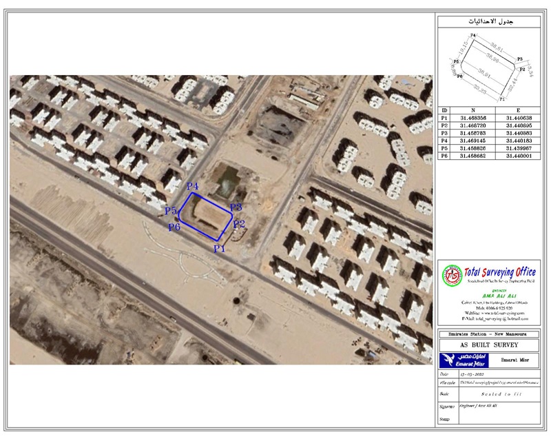
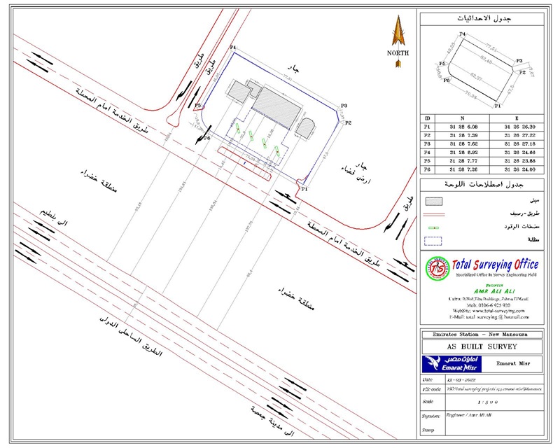
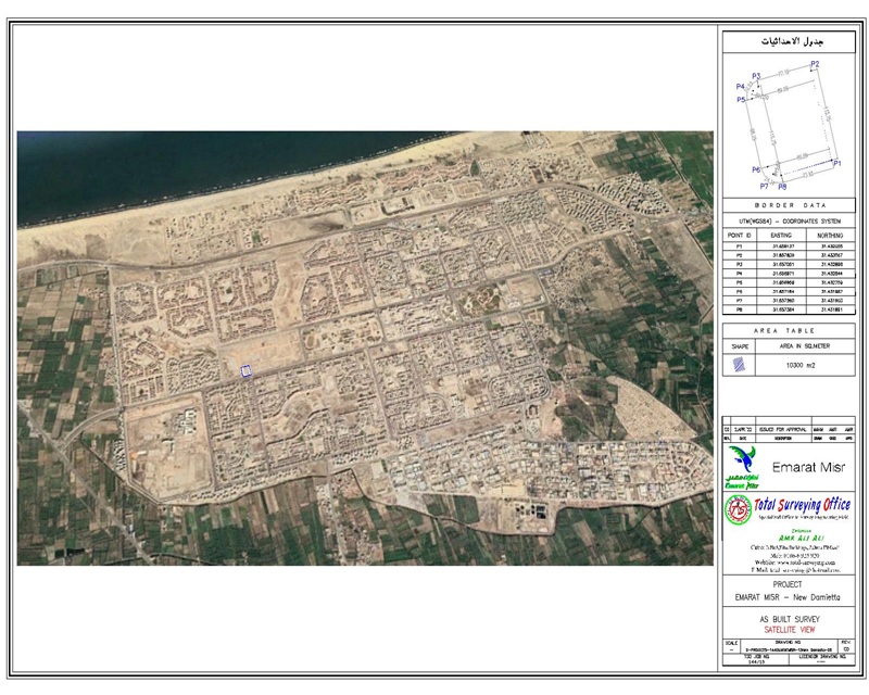
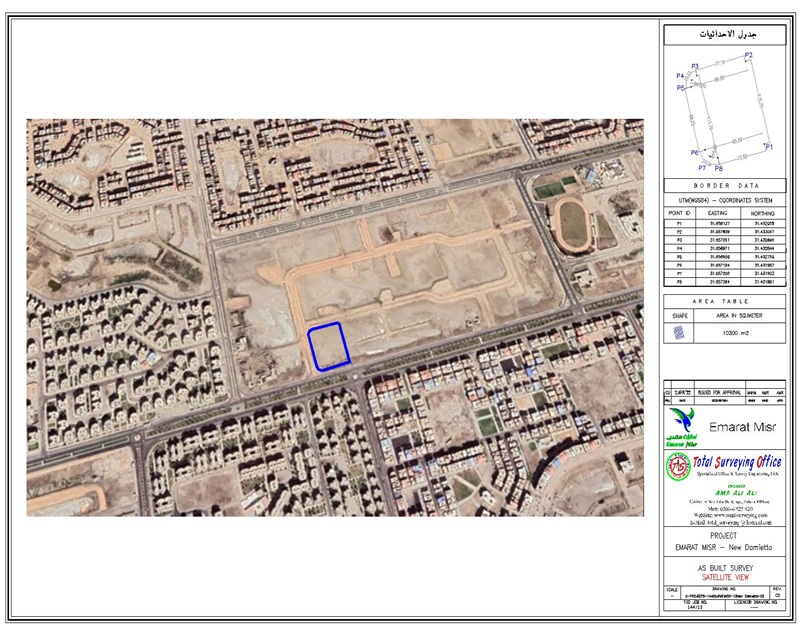
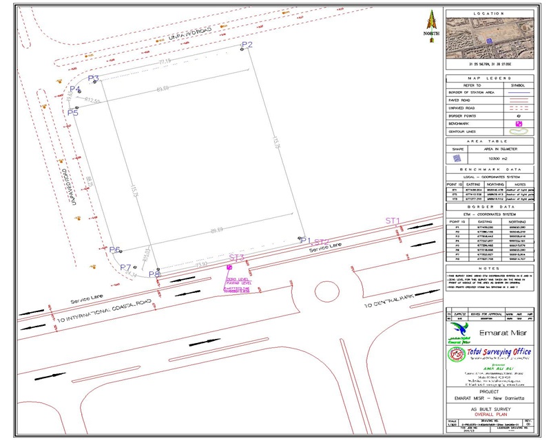
Detailed topographic surveying and site handover for Emarat Misr fuel station lands, including grid leveling, survey maps, and control points required for documentation, licensing, and construction
Scope of Work
The scope of Total Surveying Office (TSO) for Emarat Misr covered the complete surveying works for fuel station sites, from initial land handover and site surveying through the establishment of survey controls and final handover to the various contractors, including:
- Site and land handover and verification of site boundaries and existing features.
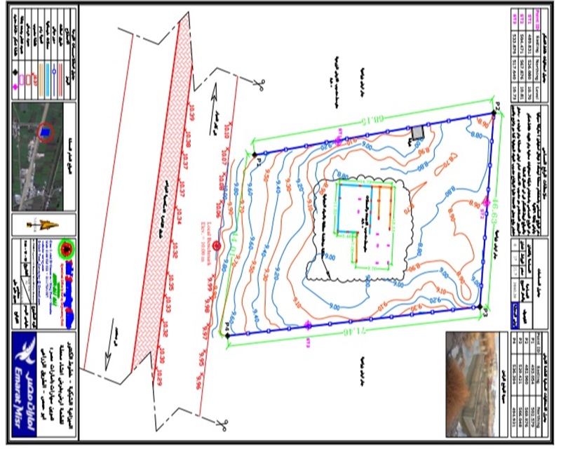
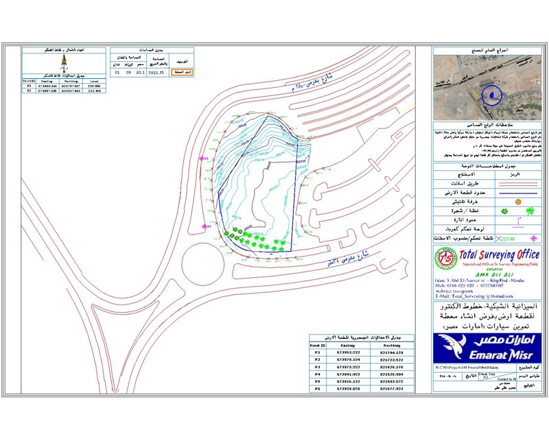
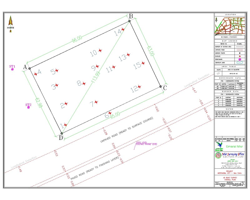
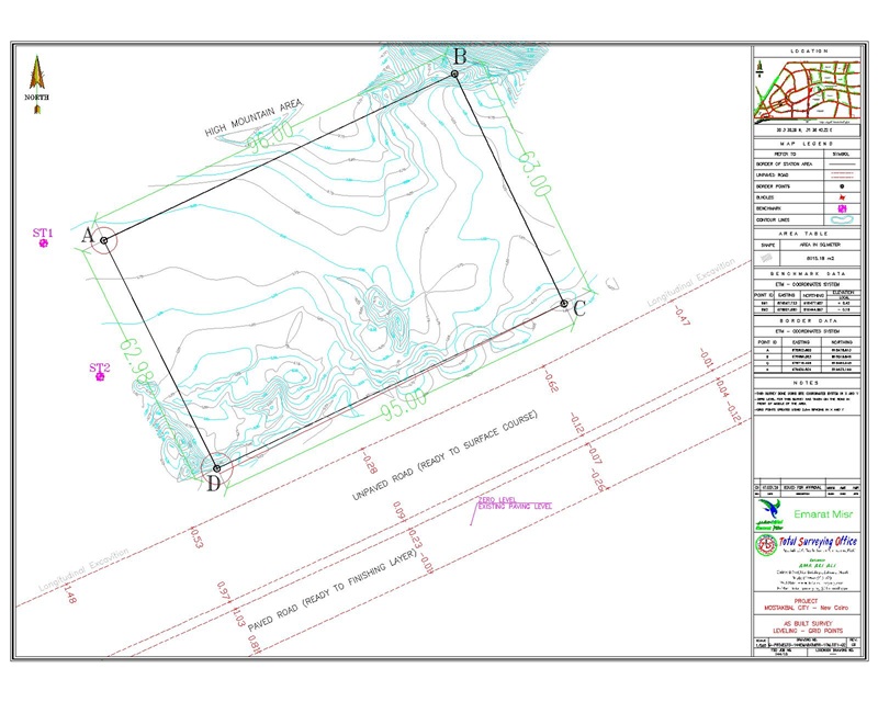
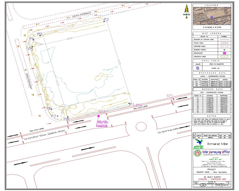
- Conducting detailed topographic surveys to accurately capture existing site conditions.
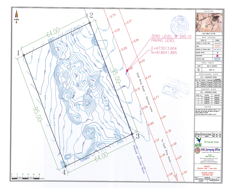
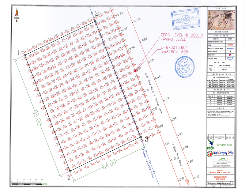
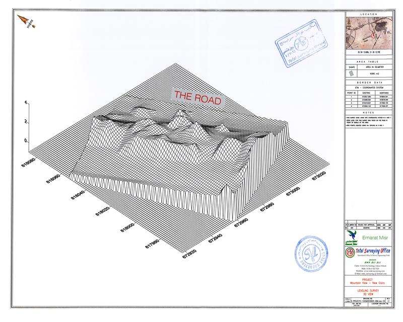
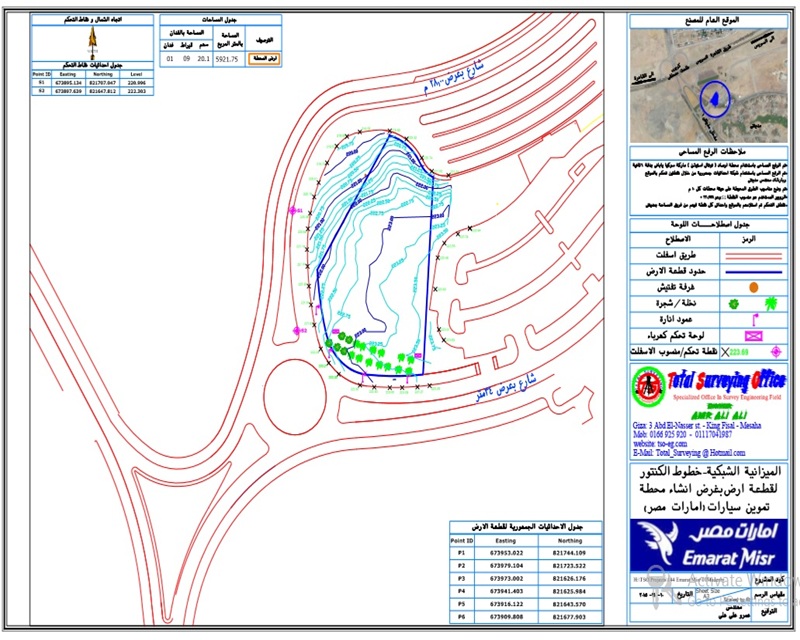
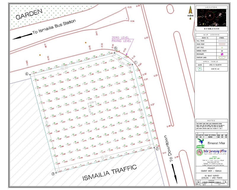
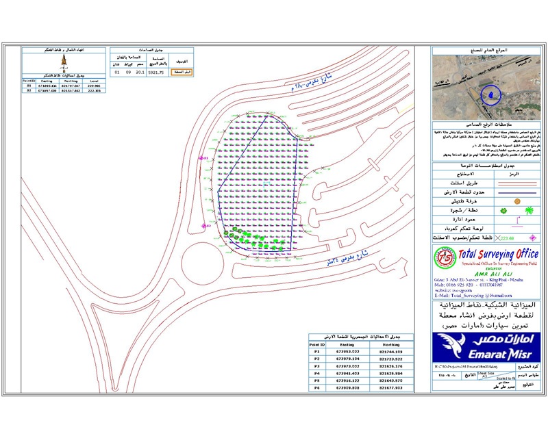
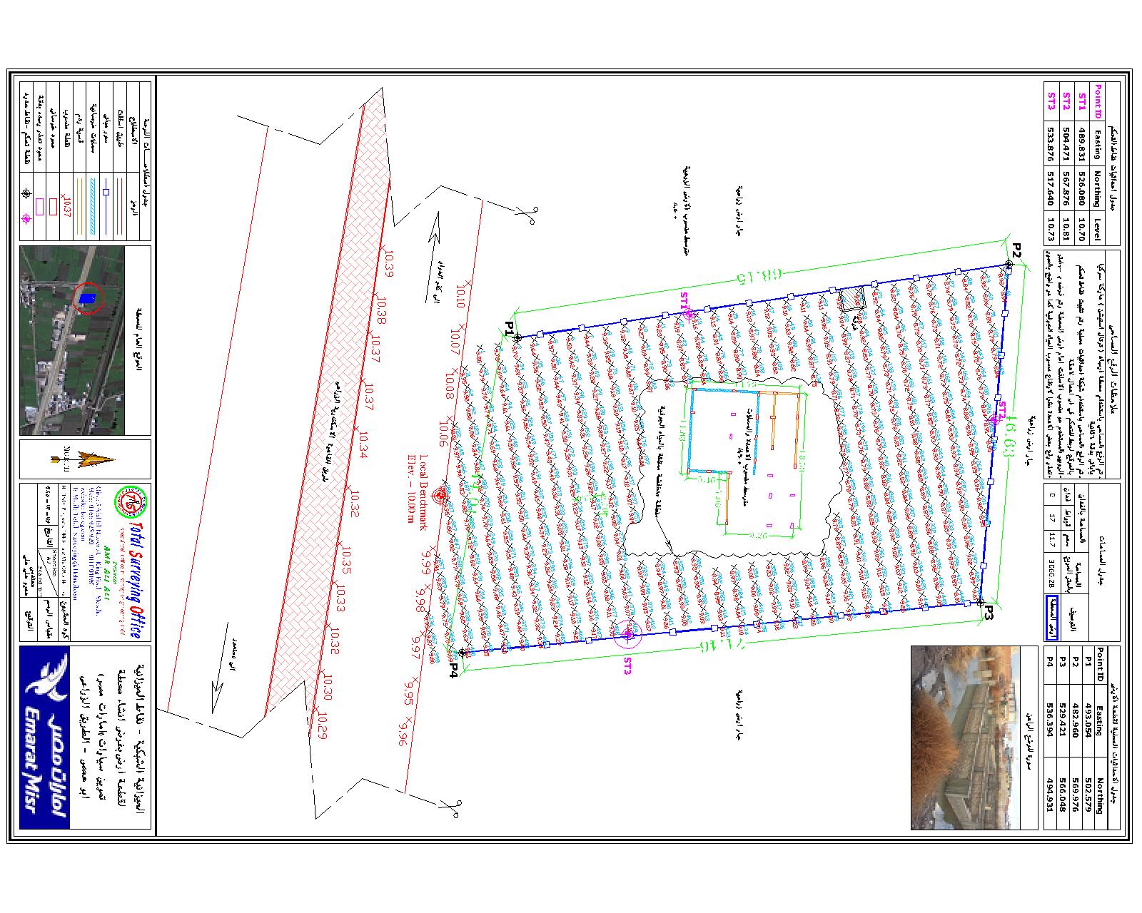
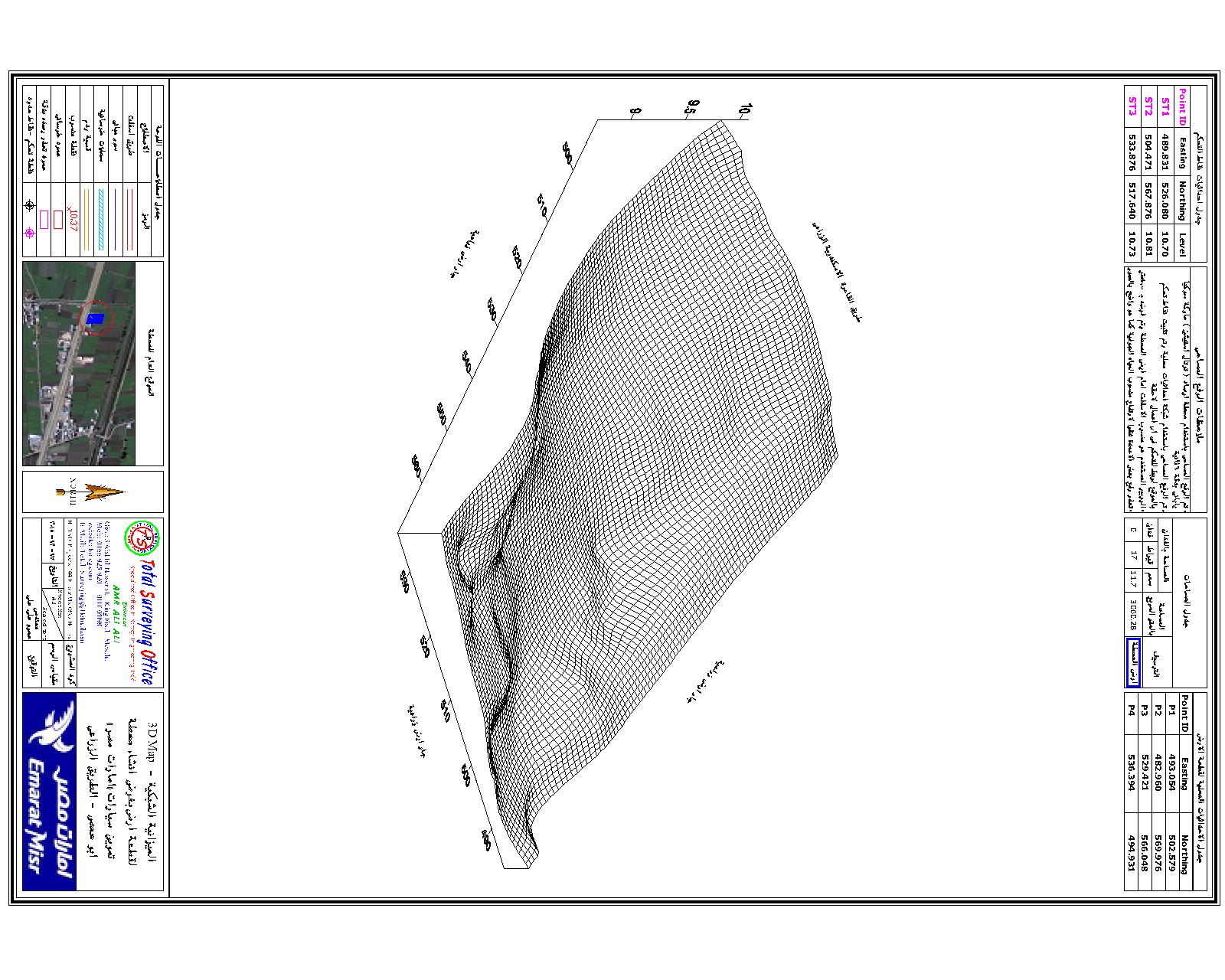
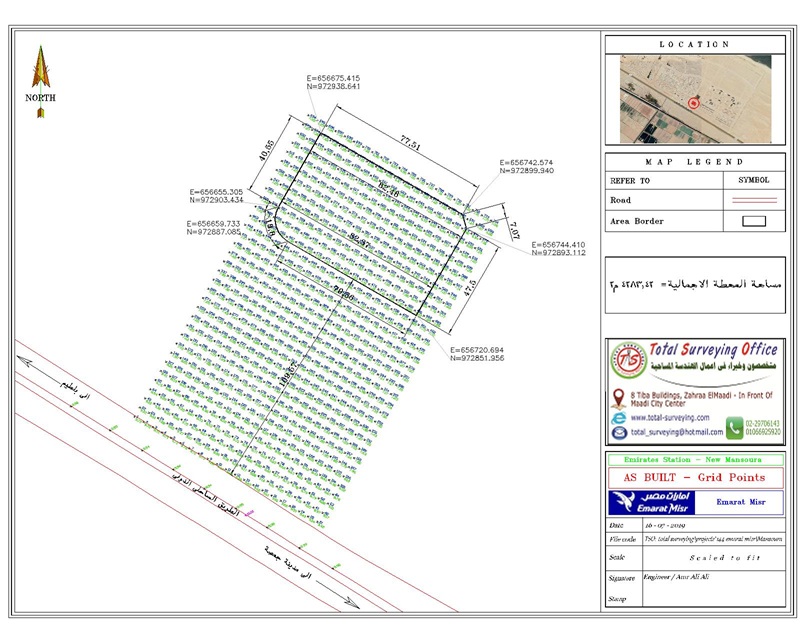
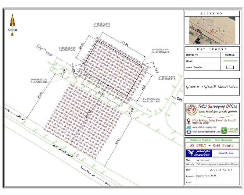
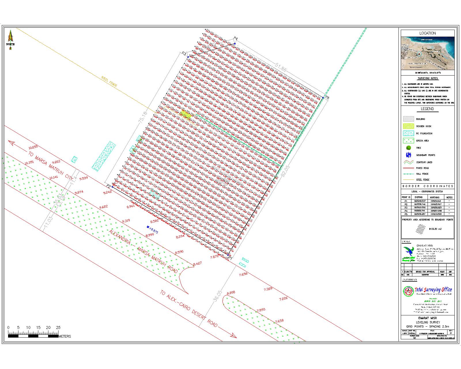
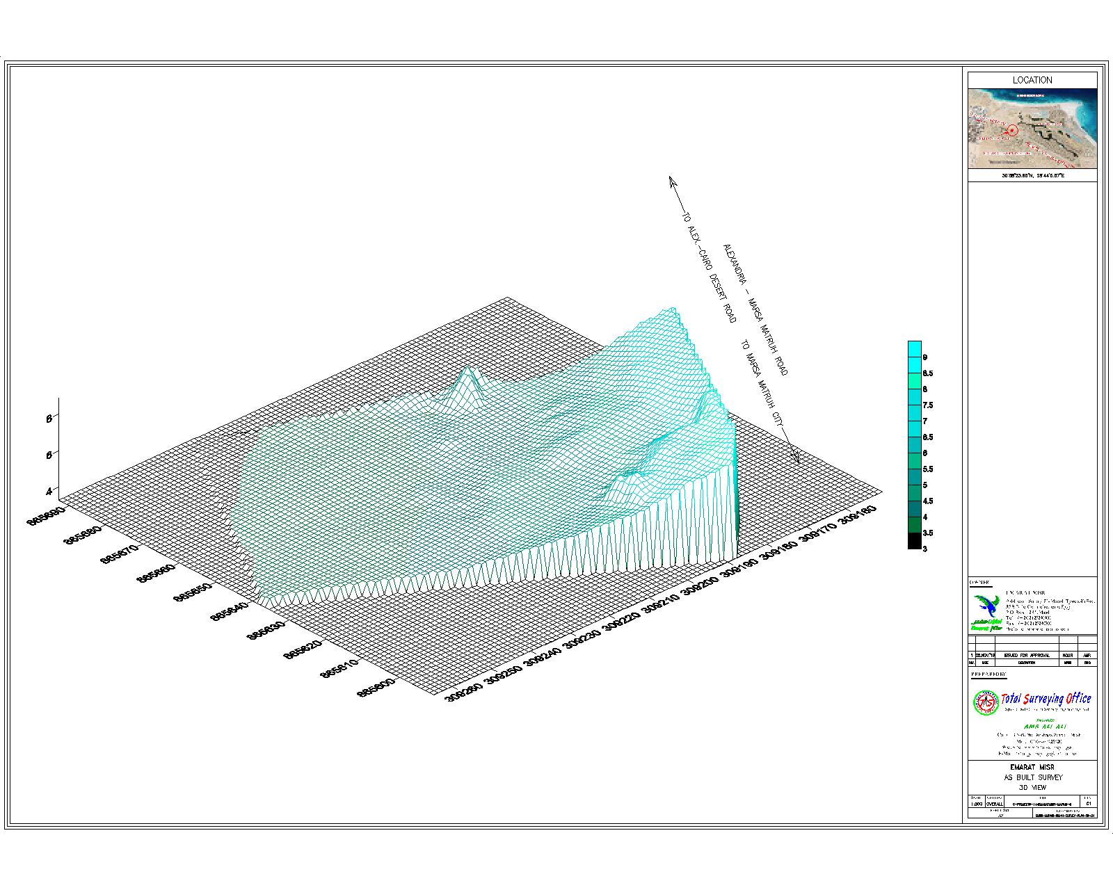
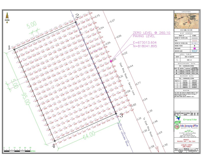
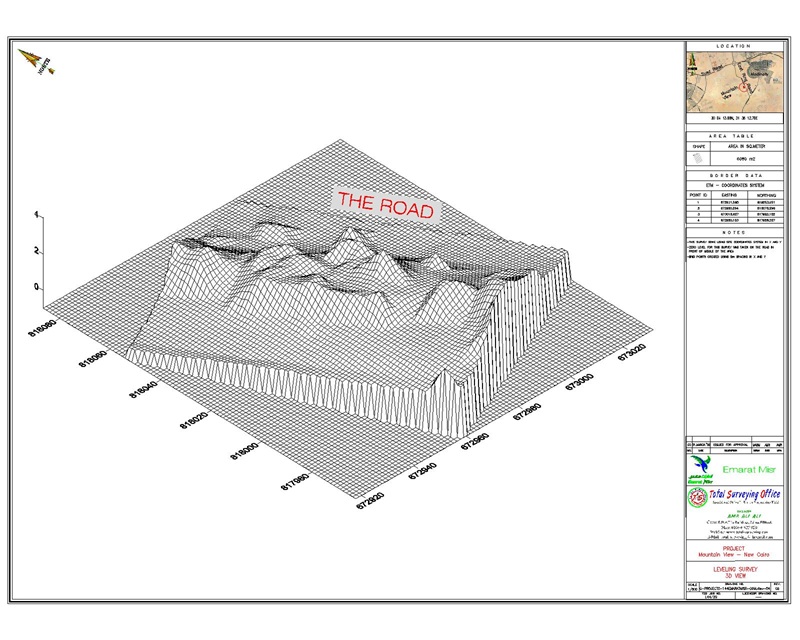
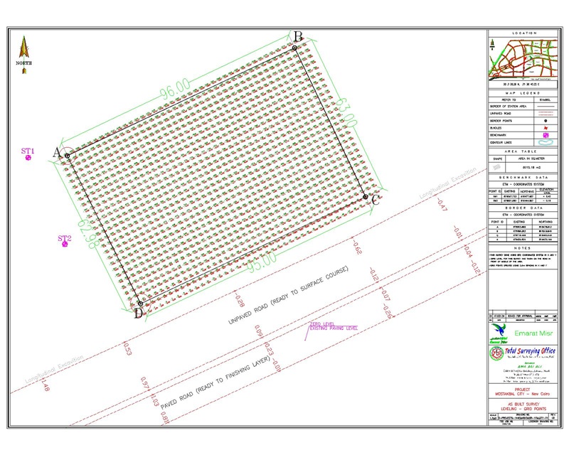
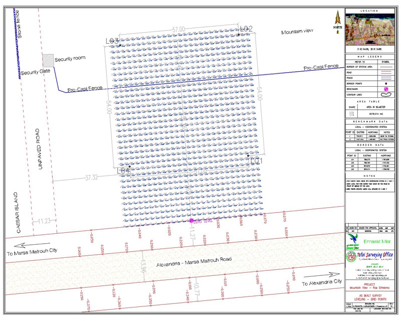
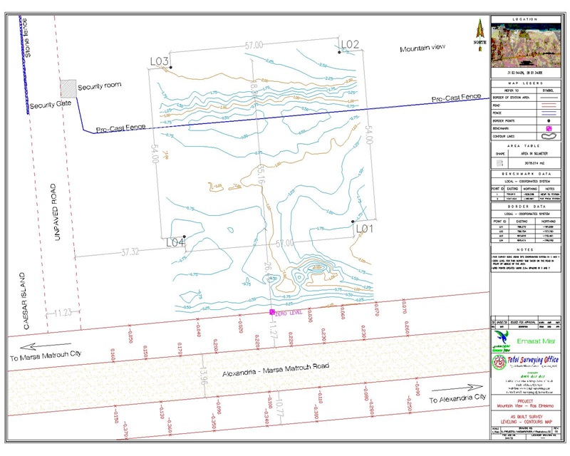
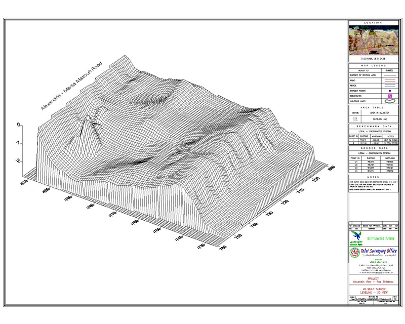
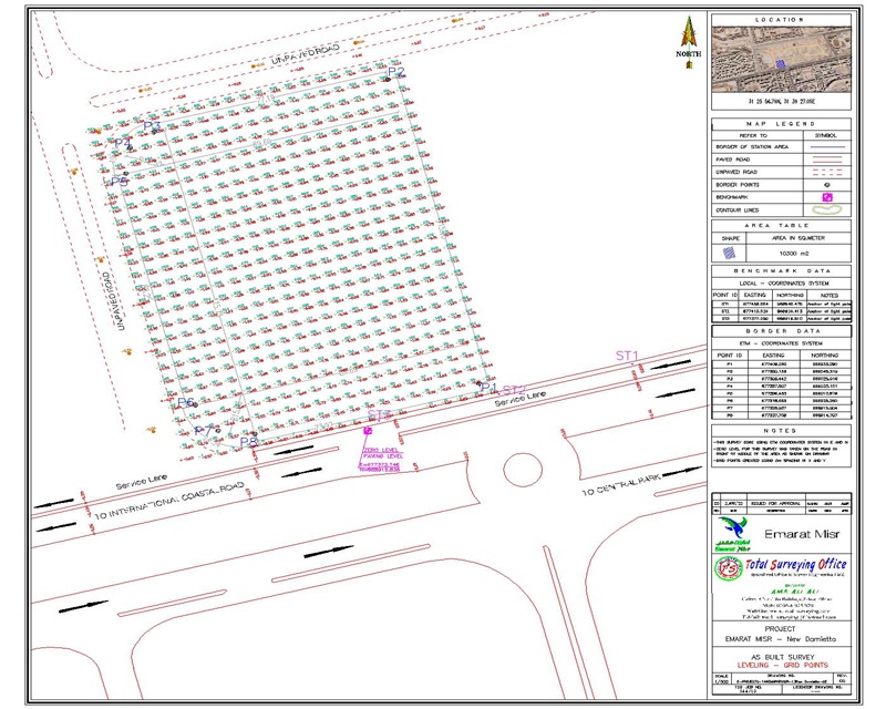
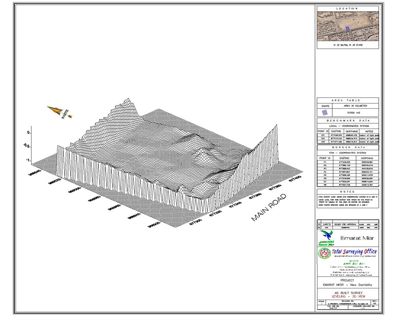
- Carrying out grid leveling and establishing accurate elevation data for the sites.
- Establishing and installing survey control points and permanent benchmarks.
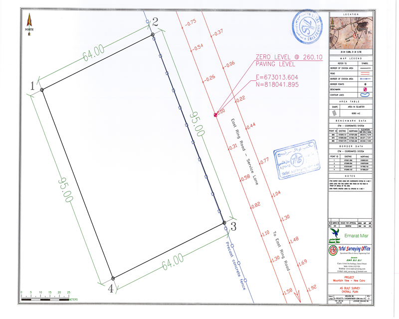
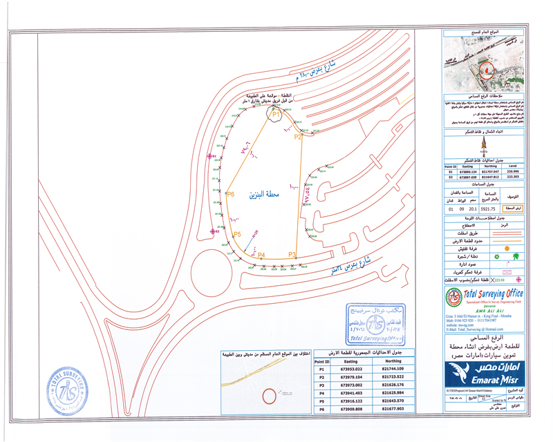
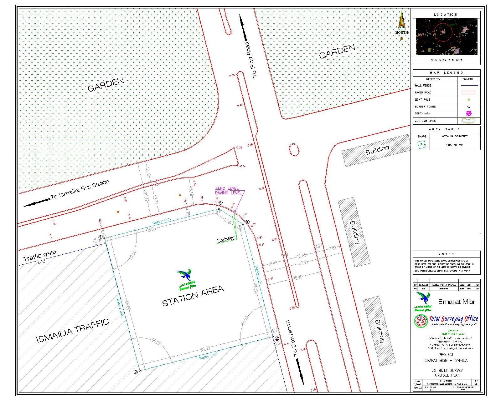
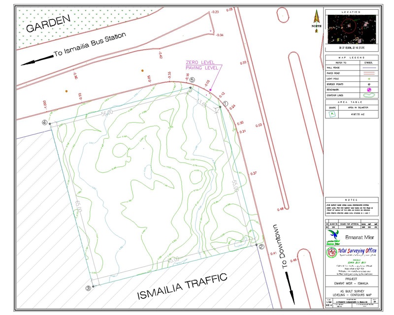
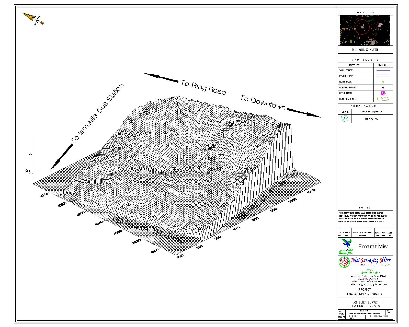
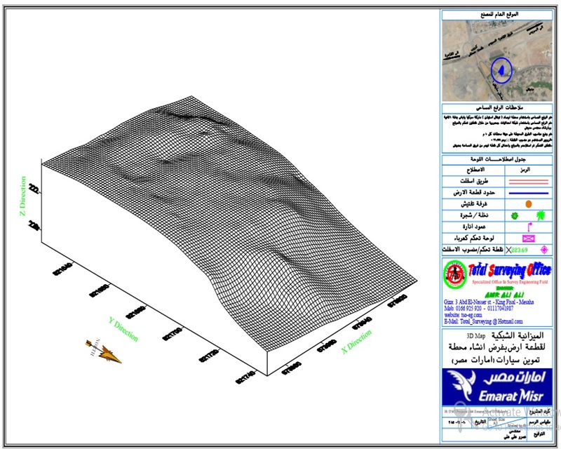
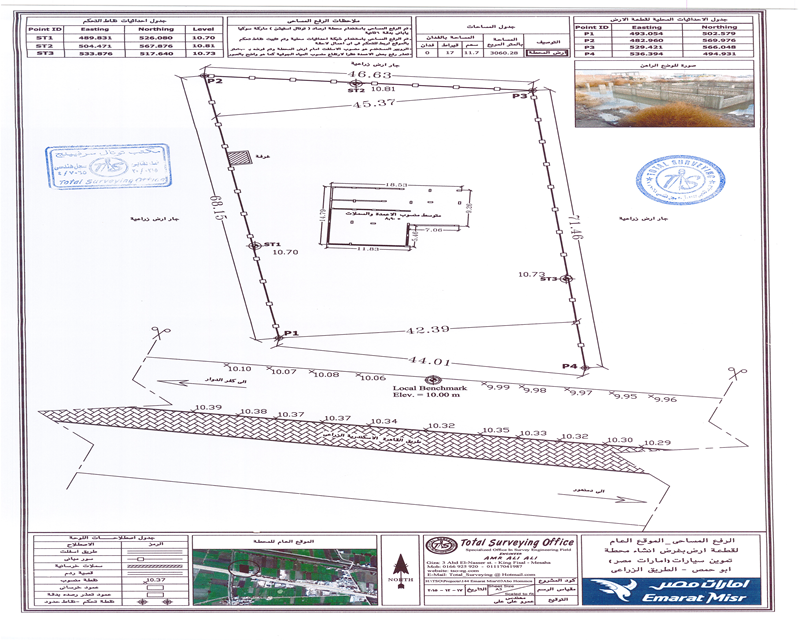
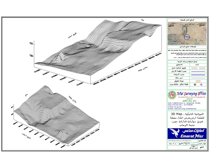
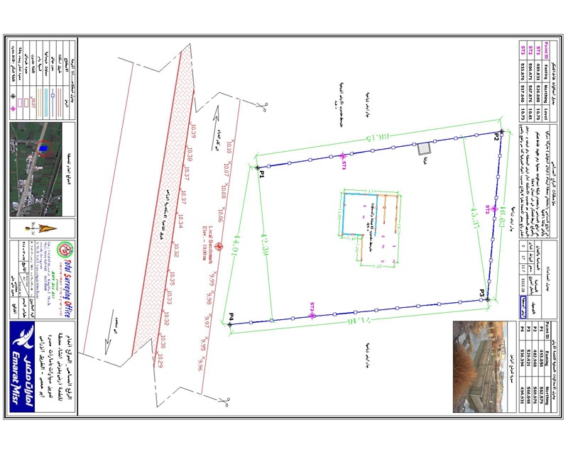
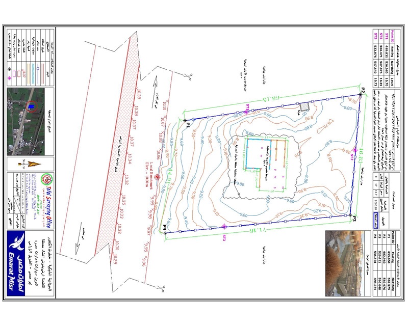
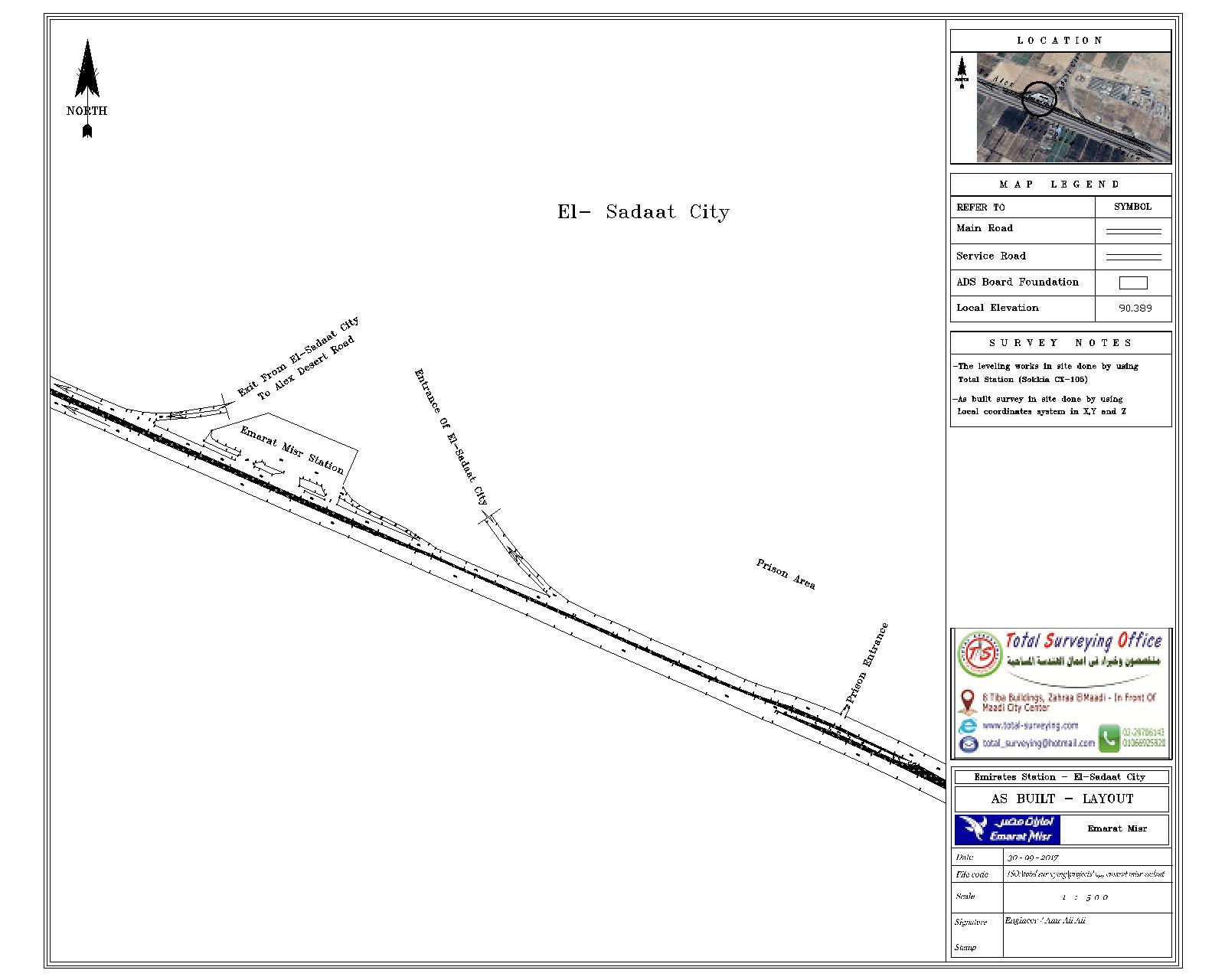
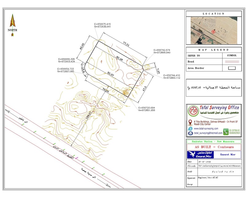
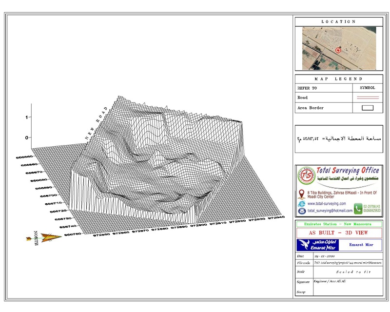
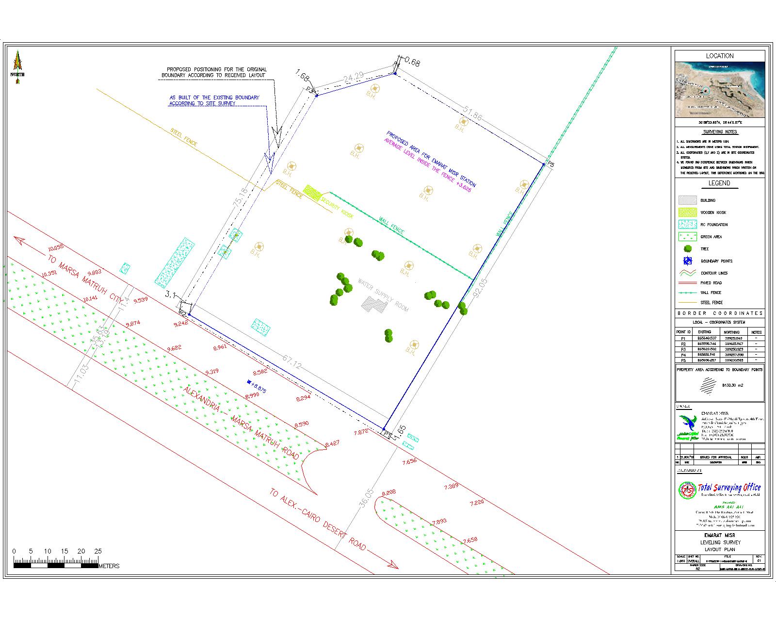
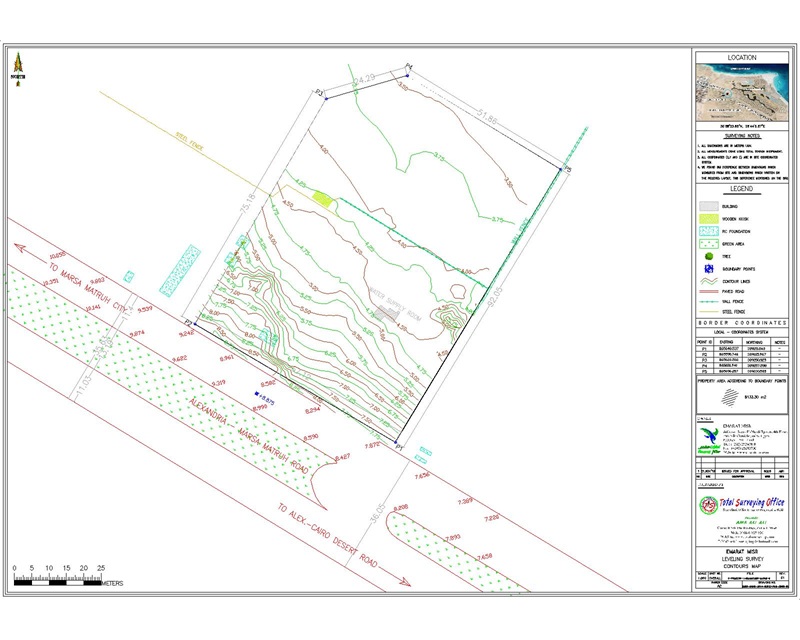
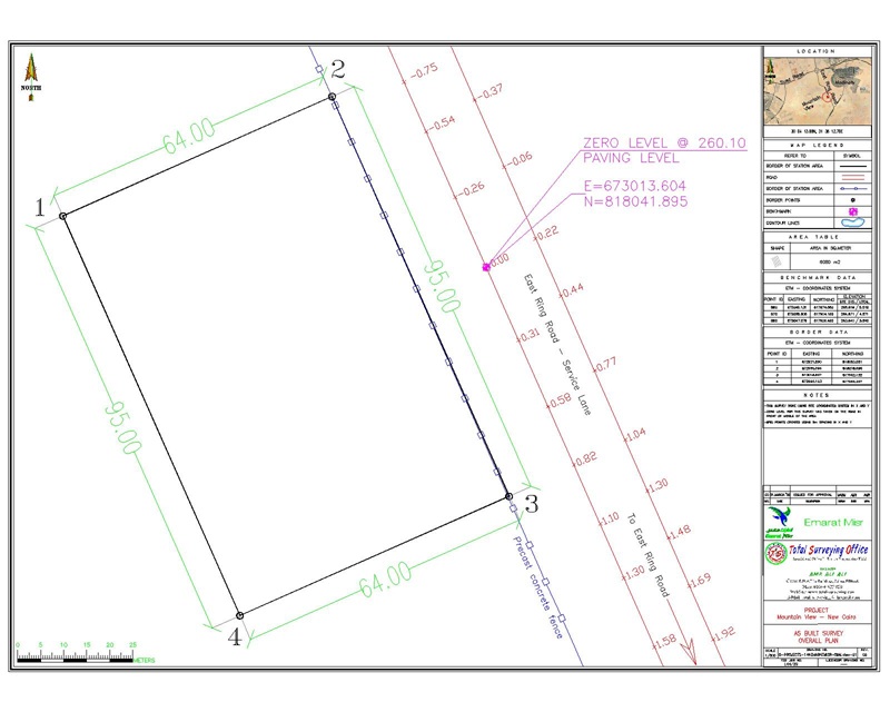
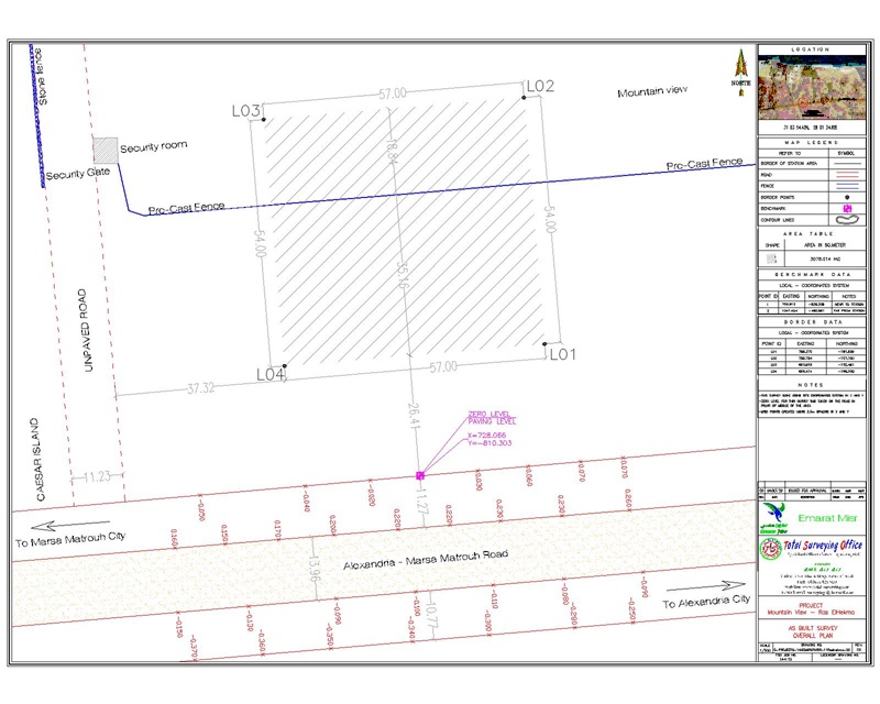
- Preparing the required survey maps, drawings, and site sketches for station documentation and licensing.
- Processing, organizing, and documenting the collected survey data and required deliverables.
- Documenting and handing over the established survey control points and their coordinates/elevations.
- Handing over the surveyed lands, survey maps, data, and established control points to the various contractors for use as references for setting-out, construction, and execution works.
- Providing the necessary surveying support during the transition from site handover and documentation to the construction phase.
Methodology
Total Surveying Office (TSO) adopted an integrated surveying methodology for the Emarat Misr fuel station sites to ensure accurate survey data, reliable deliverables, and suitable references for documentation, licensing, design, and construction activities. The methodology included the following stages:
- Site Handover and Data Review
- Receiving the land plots and verifying their locations and boundaries based on the available documents and data.
- Reviewing any existing survey control points and references.
- Conducting an initial site inspection to identify the required surveying activities and existing features.
- Establishment of Survey Control
- Establishing and securing survey control points and permanent benchmarks throughout the site.
- Determining and documenting the coordinates and elevations of the control points.
- Verifying the suitability of the established control points for subsequent surveying and construction activities.
- Detailed Topographic Survey
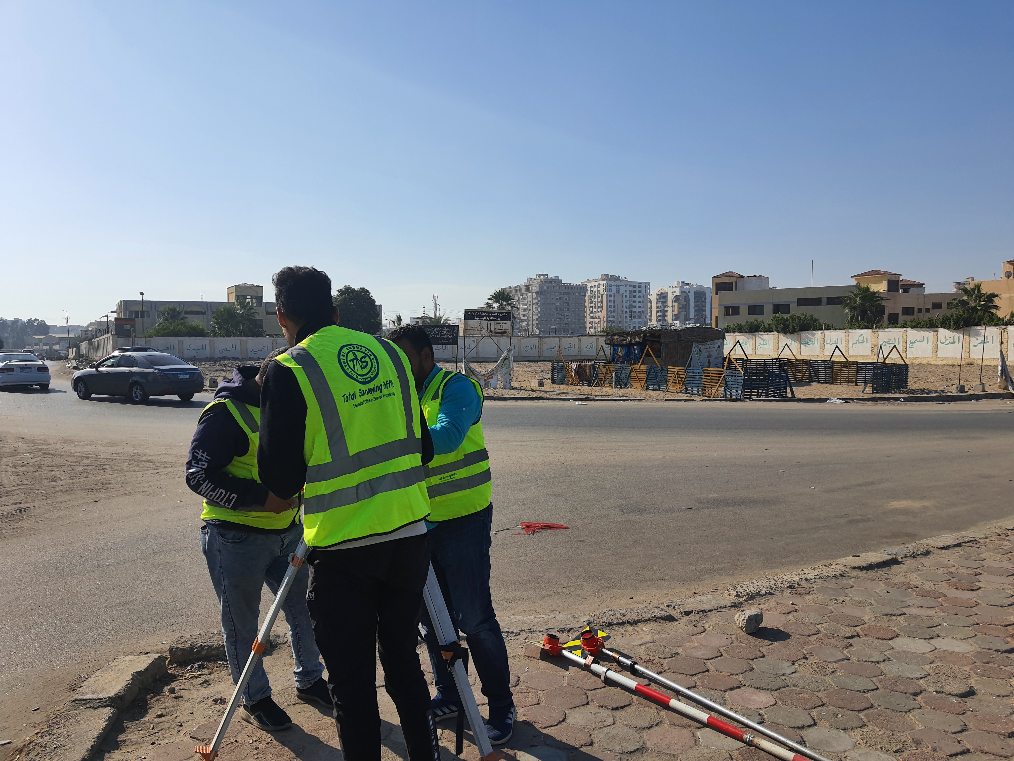
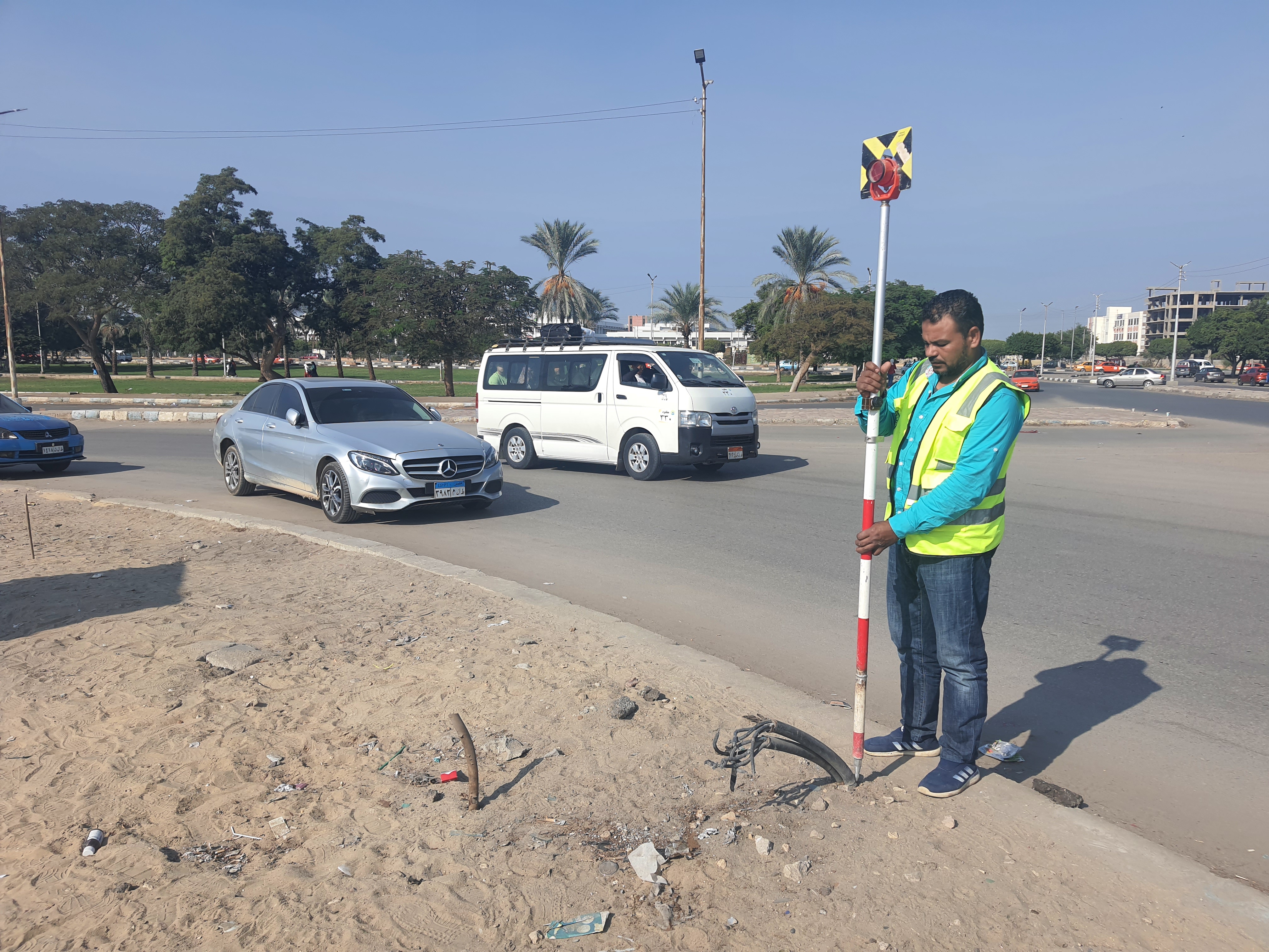
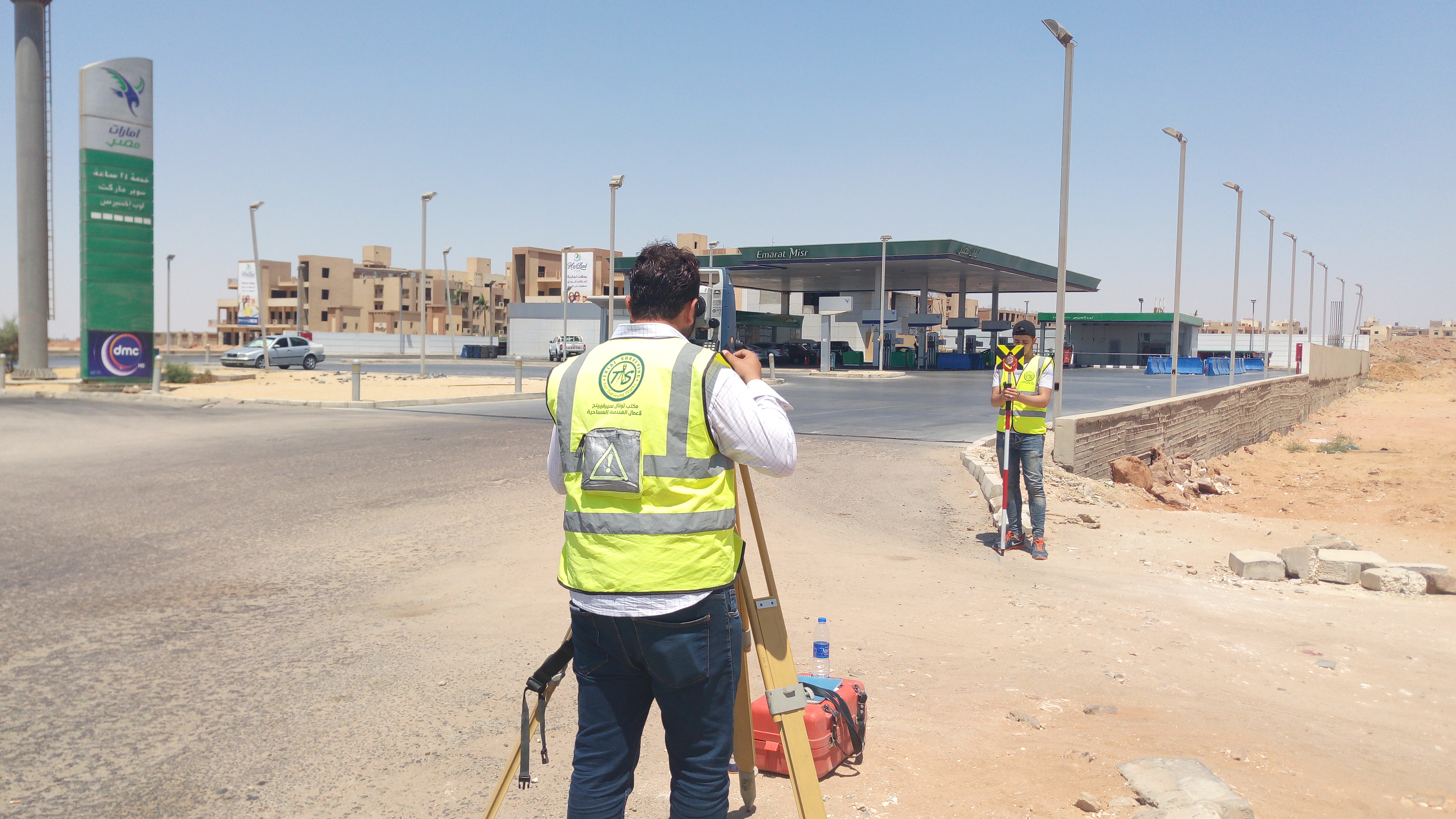
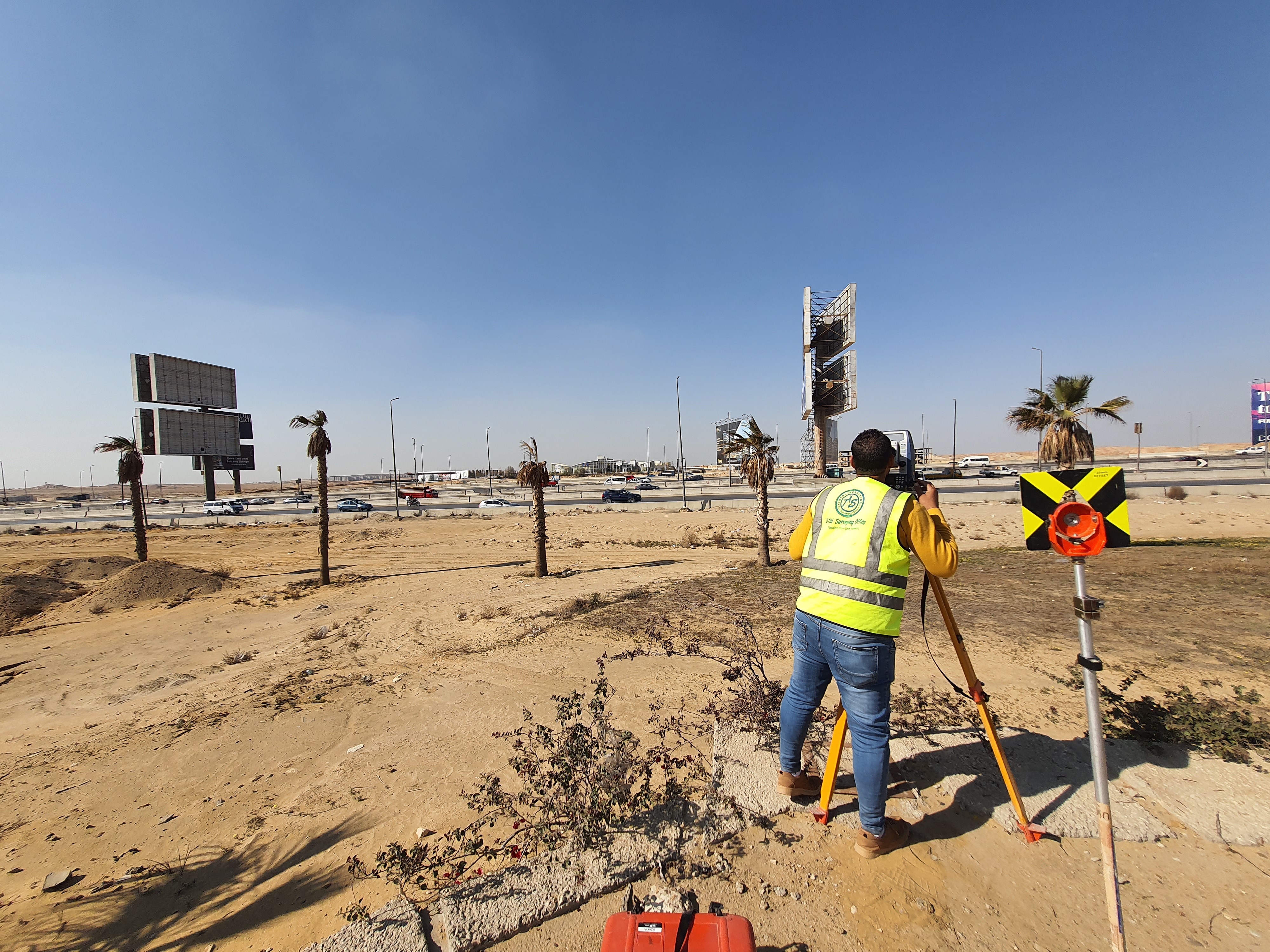
- Conducting detailed field surveys using surveying equipment appropriate to the site requirements.
- Surveying land boundaries, existing features, utilities, structures, and other relevant site elements.
- Collecting and organizing field data accurately and systematically.
- Grid Leveling
- Establishing a suitable grid of elevation points covering the required work areas.
- Observing and recording accurate ground elevations.
- Reviewing the collected elevation data and checking for abnormal readings or potential errors.
- Data Processing and Mapping
- Downloading, reviewing, and processing the field survey data.
- Processing coordinates and elevation information and preparing the survey database.
- Preparing the required survey maps, drawings, and site sketches for documentation, licensing, design, and construction purposes.
- Quality Control and Verification
- Reviewing coordinates, elevations, boundaries, and surveyed features.
- Performing appropriate checks and verification procedures before finalizing the deliverables.
- Ensuring that all required maps, drawings, survey data, and control point information are complete and properly documented.
- Final Handover and Documentation
- Preparing and delivering the final survey maps, drawings, and survey data.
- Documenting the established survey control points and their coordinates and elevations.
- Handing over the surveyed sites and established survey references to the various contractors for use in setting-out, construction, and execution activities.
Deliverables
المخرجات
شملت المخرجات النهائية لأعمال Total Surveying Office (TSO) لصالح إمارات مصر ما يلي:
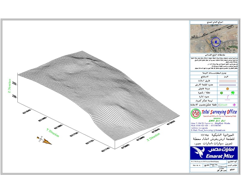
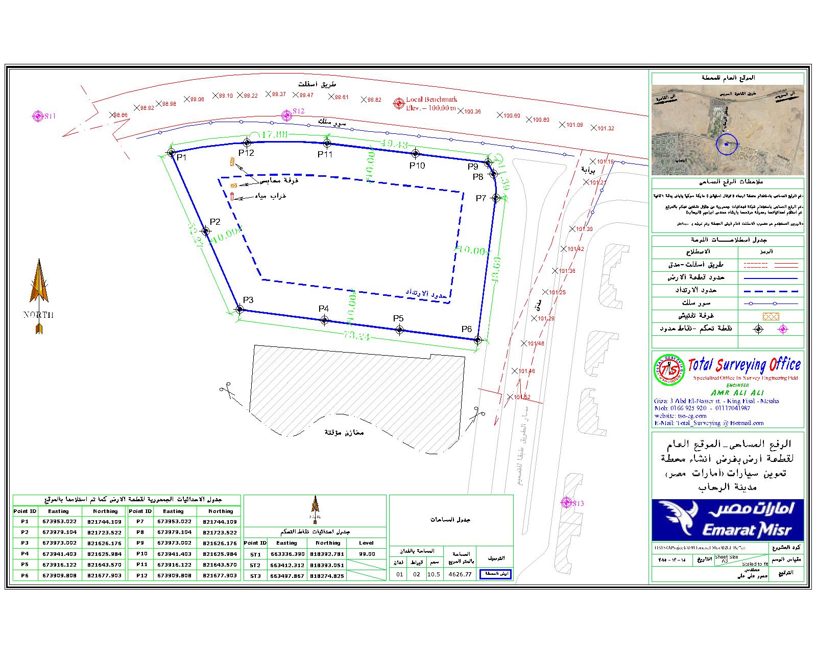
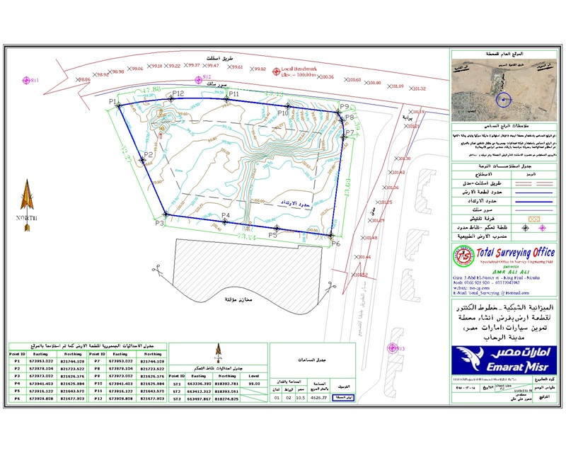
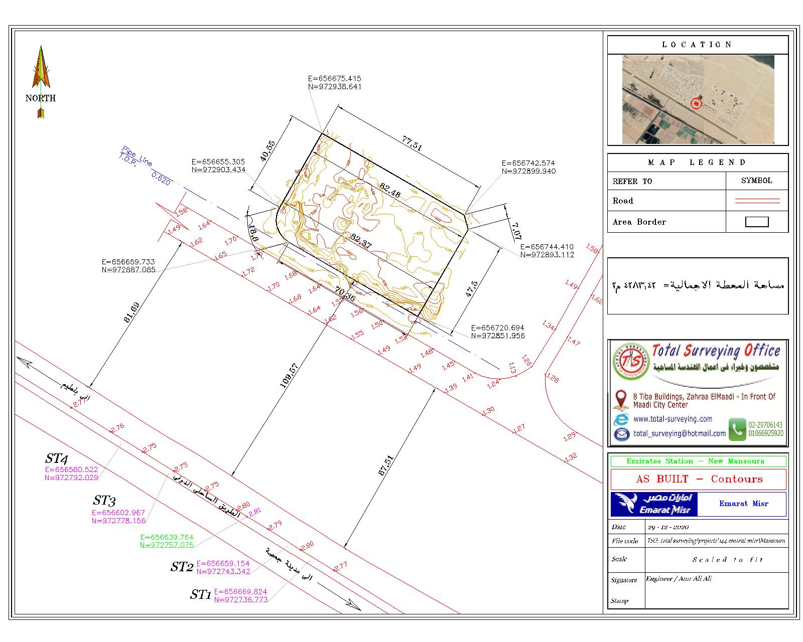
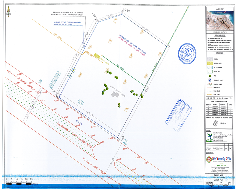
- خرائط الرفع المساحي التفصيلي للأراضي والمواقع.
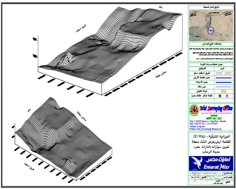
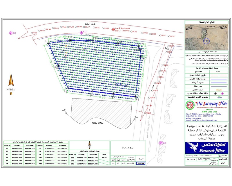
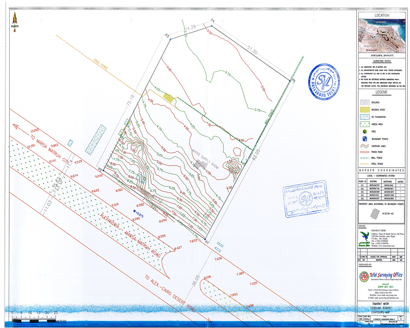
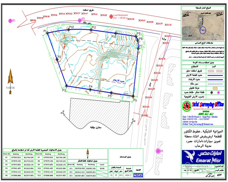
- خرائط الميزانية الشبكية موضحًا عليها المناسيب ونقاط الرفع.
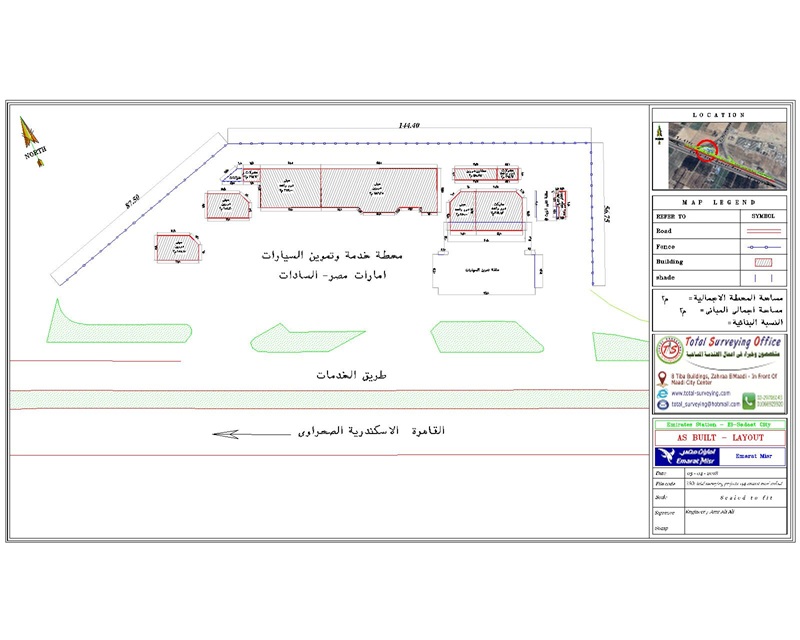
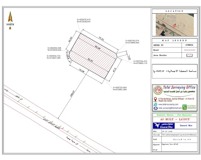
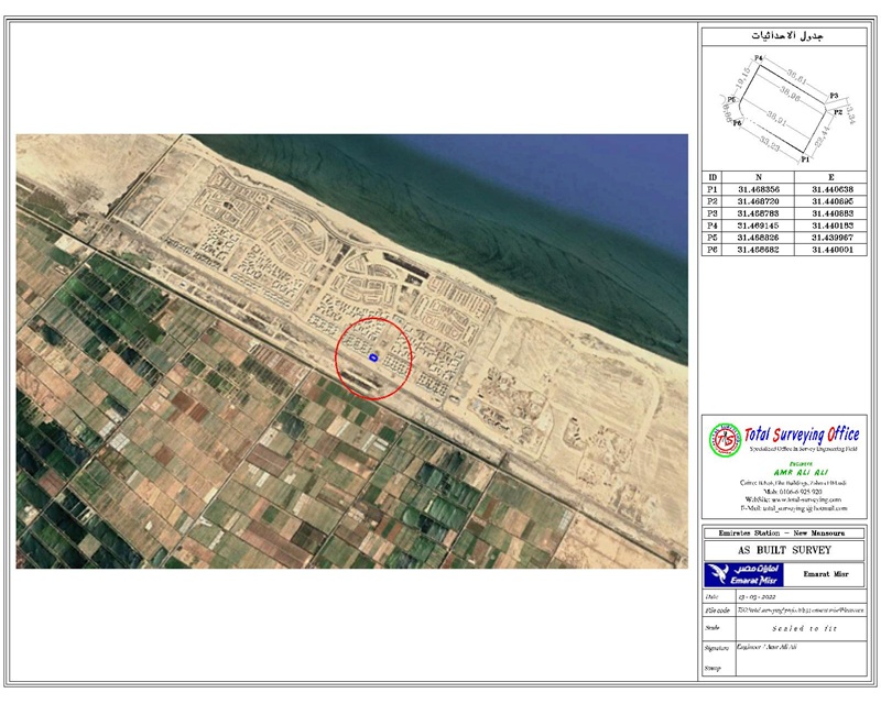
- خرائط حدود الأراضي وتحديد الأبعاد والمعالم الرئيسية للمواقع.
- الكروكيات والرسومات المساحية اللازمة لأعمال التوثيق والترخيص.
- بيانات الإحداثيات والمناسيب للنقاط المساحية الرئيسية.
- نقاط التحكم والثوابت المساحية المنشأة بالمواقع، مع توثيق بياناتها.
- قوائم الإحداثيات الخاصة بالثوابت ونقاط التحكم المساحية.
- ملفات CAD والرسومات الرقمية اللازمة للاستخدام الهندسي والتنفيذي.
- البيانات المساحية الرقمية الناتجة عن أعمال الرفع والمعالجة.
- ملفات وبيانات مساحية منظمة يمكن استخدامها في التوقيع المساحي وأعمال التنفيذ والإنشاء.
- حزمة التسليم النهائية التي تم تسليمها إلى المقاولين المختلفين لاستخدامها كمرجع مساحي أثناء تنفيذ أعمال المحطات.

Project Details

- Client: Emarat Misr
- Location: Egypt
- Year: 2026
- Industry: Oil & Gas
- Equipment: Total Stations, GNSS RTK Receivers, and Automatic Levels