
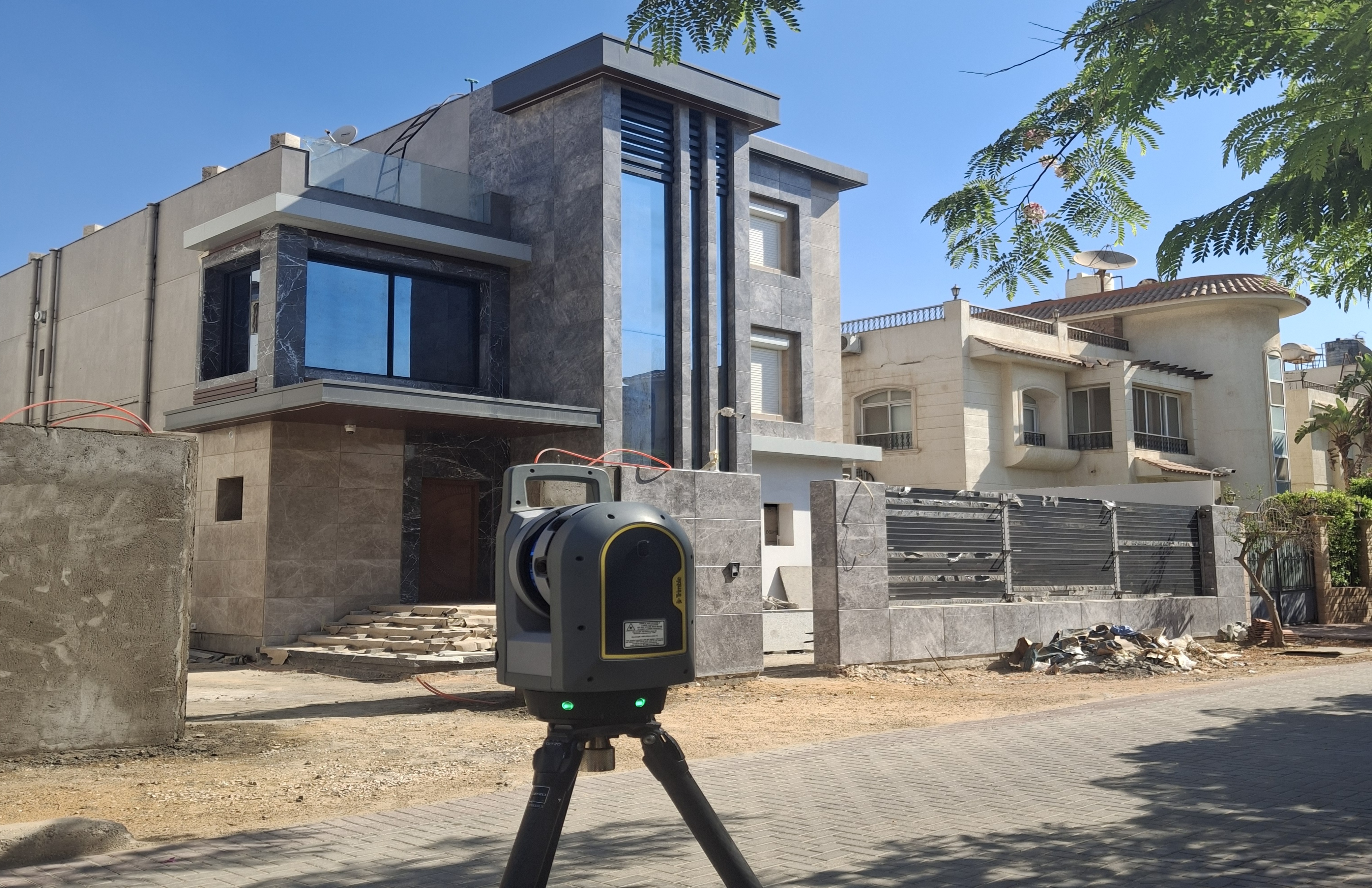
3D Laser Scanning Survey
Surveying Services
3D Laser Scanning
A modern surveying technology for collecting large volumes of engineering and spatial data with high accuracy in a short time, transforming captured information into a 3D Point Cloud that represents the actual site condition and supports measurement, design, modeling and analysis.
Accurate 3D Documentation of Existing Conditions
High-density spatial data for measurement, design and modeling
3D Laser Scanning captures millions of points from surfaces and existing elements and converts them into a dense Point Cloud representing the actual geometry and existing condition of the site with high accuracy.
The technology enables detailed documentation of buildings, structures, factories and engineering sites, with the ability to extract dimensions, elevations, facades, sections, drawings and 3D models based on the actual data collected from the site.
When required, the survey data can be connected to the approved project coordinate and elevation network using Total Station and GNSS / GPS, ensuring compatibility with the project's surveying and engineering reference system.
3D Laser Scanning Scope
Collection and documentation of spatial and engineering data
Existing Buildings & Structures
Detailed documentation of existing buildings and structures to represent actual site conditions and support design and development activities.
Factories & Industrial Facilities
Accurate surveying and documentation of factories, industrial facilities, equipment and existing works for engineering applications.
Facades & Internal Spaces
Detailed capture of external facades, rooms, internal spaces and complex engineering elements that are difficult to measure using conventional methods.
Complex Engineering Sites
Collection of large volumes of spatial data for sites with complex engineering details or difficult-to-access elements.
Survey Execution Methodology
Organized steps from site study to an integrated Point Cloud
Site Study & Survey Scope
Survey Control & Registration
Laser Scanning
Point Cloud Registration
Surveying Equipment & Technologies
Integrated surveying instruments and data-processing technologies
3D Laser Scanner
Captures millions of points and records detailed geometric and spatial information from existing surfaces and elements.
Total Station
Used for survey control, registration, coordinates, elevations and reference points when required.
GNSS / GPS
Connects the scanning survey to the geographic or approved project coordinate and elevation system.
Data Processing
Registration and processing of Point Cloud data using specialized software and preparation for engineering applications.
Point Cloud Processing & Analysis
Transforming field data into measurable and usable engineering products
Point Cloud
A dense 3D point cloud representing the surfaces and existing elements captured during the survey.
Measurement Extraction
Extraction of distances, dimensions, elevations, angles and other engineering information from the Point Cloud.
Drawings & Sections
Production of plans, facades and sections based on the actual surveyed site data.
3D Models
Creation of digital 3D models for design, documentation, analysis and engineering modeling.
3D Laser Scanning Applications
3D data that can be used throughout multiple project stages
▰
As-Built Documentation
Accurate documentation representing the actual condition of existing buildings and structures.
▱
Redrawing Existing Plans
Production of plans for existing buildings and structures based on actual surveyed data.
⌂
Engineering Facades & Sections
Extraction of accurate facades and sections directly from the Point Cloud.
⚒
Restoration & Rehabilitation
Documentation of existing conditions before restoration, rehabilitation and development works.
⚙
Factories & Industrial Facilities
Documentation of industrial facilities, equipment and existing works.
⌘
Equipment & Existing Works
Accurate spatial information for existing equipment, installations and site elements.
◇
Multidisciplinary Coordination
Coordination between architectural, structural and mechanical works.
◈
BIM & Digital Modeling
Using 3D survey data to support digital and engineering modeling.
×
Clash Detection
Using 3D data to identify conflicts between architectural, structural and MEP elements.
↔
Before & After Documentation
Documentation and comparison of site conditions before and after construction or development.
Survey Deliverables
Surveying and engineering data prepared for project applications
Point Cloud Files
3D Point Cloud files representing the actual site condition and existing elements.
Survey Drawings
Engineering drawings extracted from the actual surveyed site data.
Facades & Sections
Accurate facades and sections representing the existing condition of buildings and structures.
3D Models
Digital 3D models for design, documentation and engineering analysis.
A Comprehensive 3D Database of Existing Site Conditions
3D Laser Scanning provides a high-capacity method for collecting large volumes of spatial data in a short time while preserving detailed engineering information. The captured data can be revisited and measured later without repeating the complete field survey.
A comprehensive Point Cloud also reduces the need for repeated site visits and provides design, construction and consulting teams with a realistic database of the actual site condition that can support multiple stages of the project.
Do You Need 3D Laser Scanning for Your Project?
The Total Surveying Office team can review your site, project requirements, survey scope and required deliverables before execution.
Need this service?
Request a free, no-obligation quote and our team will get back to you shortly.
Request a Quote