
The Latest Equipment Used in Engineering Surveying
ENGINEERING SURVEYING TECHNOLOGY
Latest Equipment Used in Engineering Surveying
Modern surveying equipment plays a major role in improving accuracy, reducing fieldwork time, and producing reliable surveying data for construction, infrastructure, real estate, and engineering projects.
Development of Engineering Surveying Equipment
Modern technologies for faster and more accurate surveying
Engineering surveying has witnessed significant technological development in recent years. Modern surveying instruments have contributed to achieving higher accuracy, faster field data collection, and better control over surveying operations.
The use of advanced equipment also helps reduce human errors, improve the quality of surveying data, and produce accurate maps, coordinates, levels, and engineering reports that can be relied upon during design and construction.
This development has become particularly important in the Egyptian market due to the increasing number of national projects, new cities, infrastructure developments, land reclamation projects, and major real estate and industrial developments.
Choosing the appropriate surveying equipment depends on the nature of the project, required accuracy, site conditions, survey area, required deliverables, and the type of information that needs to be collected.
Latest Equipment Used in Engineering Surveying
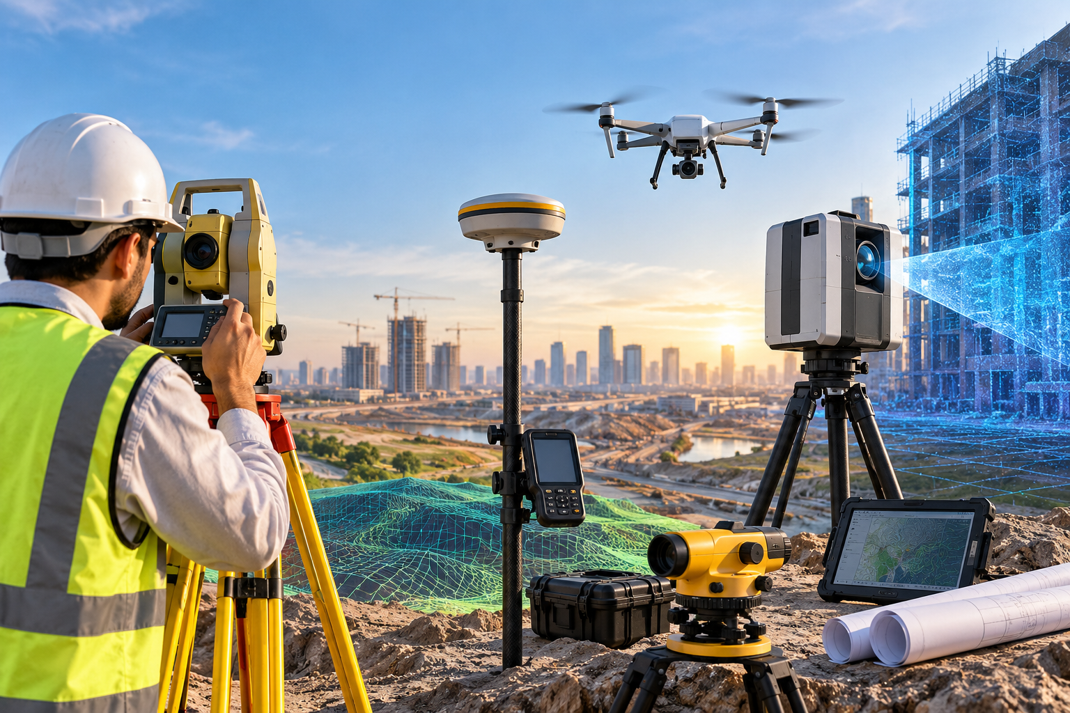
Key technologies used for modern surveying operations
Total Station
An advanced electronic surveying instrument that combines angle measurement with Electronic Distance Measurement (EDM), allowing accurate measurement and digital recording of surveying observations.
GPS / GNSS Surveying Receivers
Satellite-based positioning systems capable of providing centimeter-level positioning accuracy and efficient coordinate collection over large areas.
LiDAR Technology
Laser-based technology used to collect dense three-dimensional information and generate accurate terrain and surface models, especially for large or difficult areas.
Surveying Drones
UAV platforms equipped with high-resolution cameras and, in some applications, laser sensors for rapid aerial data acquisition and mapping.
Automatic and Digital Levels
Instruments used for precise leveling operations, elevation control, grid leveling, and cut-and-fill quantity calculations in construction and engineering projects.
3D Laser Scanners
High-performance scanning systems used to capture detailed three-dimensional information and create dense point clouds for existing-condition surveys and 3D documentation.
Total Station
Accurate measurement of angles, distances, and coordinates
The Total Station is one of the most widely used instruments in engineering surveying. It combines the functions of an electronic theodolite with Electronic Distance Measurement (EDM), allowing surveyors to measure horizontal and vertical angles as well as distances with high accuracy.
Modern Total Stations can store field observations electronically, calculate coordinates, perform stakeout operations, and transfer surveying data directly to computers and engineering software.
Total Stations are widely used in construction projects, real estate developments, roads, infrastructure works, industrial facilities, structural setting out, and detailed surveying operations.
GPS / GNSS Surveying Receivers
High-accuracy satellite positioning and coordinate collection
GPS and GNSS surveying receivers use signals from navigation satellites to determine accurate positions and coordinates. Modern GNSS technology can achieve centimeter-level positioning accuracy when appropriate correction techniques are used.
GNSS surveying is particularly useful for large sites and projects where a significant number of coordinates need to be collected efficiently.
It is commonly used in road and infrastructure projects, airports, land development, utility surveys, topographic surveys, control networks, and large-scale engineering projects.
LiDAR and 3D Laser Scanning
Advanced three-dimensional data acquisition
LiDAR technology uses laser measurements to collect detailed information about terrain, structures, surfaces, and surrounding features. The collected data can be processed into detailed three-dimensional models and point clouds.
Three-dimensional laser scanning provides a high-density representation of existing conditions and can capture complex geometries that may be difficult to document using conventional surveying methods alone.
These technologies are particularly valuable for major development projects, new cities, industrial facilities, infrastructure, difficult terrain, existing-condition documentation, and three-dimensional engineering applications.
Surveying Drones
Rapid aerial imagery and large-area data collection
Surveying drones equipped with high-resolution cameras provide an efficient method for collecting aerial imagery over large areas. The captured images can be processed to produce orthophotos, digital surface models, and other mapping products.
In some applications, drones may also be equipped with laser surveying sensors, allowing the collection of additional three-dimensional information.
Drone surveying is increasingly useful for real estate projects, agricultural areas, land reclamation, infrastructure corridors, large construction sites, and locations where conventional field surveying would require significant time and resources.
Automatic and Digital Levels
Precise elevation and leveling control
Automatic and digital levels are essential surveying instruments for determining elevation differences and establishing accurate level control on construction and engineering sites.
They are commonly used for grid leveling, road projects, foundations, earthworks, drainage systems, and establishing construction levels.
Accurate leveling data is also essential for calculating excavation and backfilling quantities and for controlling the required elevations throughout the construction process.
Importance of Modern Surveying Equipment in Egypt
Technology supporting the growing Egyptian construction market
High Accuracy
Modern equipment provides accurate coordinates, elevations, measurements, and mapping data for complex engineering projects.
New Cities and Major Projects
Advanced surveying technologies support large-scale developments such as new cities and major national projects.
Saving Time
Modern instruments accelerate field data collection and reduce the time required to complete large surveying works.
Reducing Project Costs
Faster field operations and improved data quality can contribute to better project efficiency and cost control.
Reliable Surveying Reports
Accurate field measurements help produce reliable maps, drawings, coordinates, and technical reports.
International Standards
Modern surveying technologies help engineering projects meet professional requirements and internationally recognized surveying practices.
How Is the Right Surveying Equipment Selected?
Equipment selection depends on project requirements
There is no single surveying instrument suitable for every project. The appropriate equipment is selected according to the required accuracy, project size, terrain conditions, accessibility, required survey products, and available project control.
Total Stations are highly suitable for detailed measurements, setting out, construction control, and areas where direct observations are required.
GNSS receivers are particularly effective for establishing coordinates and surveying large open areas, while digital levels are preferred when precise elevation control is required.
Laser scanners and LiDAR systems are especially useful when detailed three-dimensional documentation and dense point-cloud data are required, while drones can provide efficient aerial coverage of large areas.
How Can You Benefit from Total Surveying Office?
Total Surveying Office (TSO) uses modern surveying technologies and equipment appropriate to the requirements of each project, including Total Stations, GPS / GNSS systems, digital levels, laser scanning technologies, and other specialized surveying solutions.
Our engineering surveying team has practical experience in different types of projects and focuses on accurate field measurements, professional data processing, and reliable surveying deliverables.
TSO provides surveying maps, reports, coordinates, drawings, and technical deliverables suitable for project owners, consultants, contractors, and engineering applications.
Conclusion
The right technology makes surveying more efficient
Modern surveying equipment has become an essential part of engineering and construction projects. The combination of Total Stations, GNSS receivers, digital levels, LiDAR, laser scanners, and surveying drones allows surveying teams to collect more accurate and detailed information in less time.
The key is not simply using the latest instrument, but selecting the appropriate technology and applying it correctly according to the project requirements and required accuracy.
Professional surveying remains dependent on qualified surveyors, proper field procedures, quality control, accurate data processing, and the appropriate combination of surveying technologies.
Related Articles
More surveying and engineering topics from TSO
3D Surveying Using Laser Scanner Technology
Learn more about three-dimensional surveying and laser scanning applications.
Survey Monitoring of Industrial Structures During Mechanical Overhaul
How surveying monitoring can help maintain structural stability during heavy equipment dismantling and installation.
Obstacle Surveying Around a Hospital Helicopter Landing Area
Surveying and documenting obstacles surrounding a hospital helicopter landing area.
Do You Need a Survey Using Modern Technology?
Total Surveying Office provides professional surveying services using modern surveying equipment and technologies selected according to the requirements of each project.
Comments (0)
Be the first to comment on this article.