
importance of setting out in construction projects
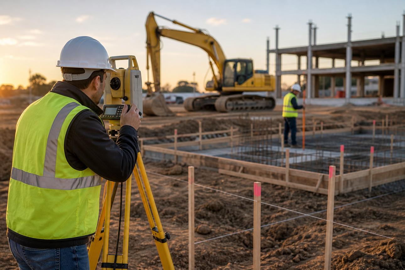
The Importance of Survey Setting Out in Construction Projects

Introduction
Survey setting out is one of the fundamental stages in construction projects. It serves as the link between engineering designs and their physical implementation on the ground. Before excavation, concrete pouring, or the construction of roads and utilities begins, the positions, axes, and elevations of the project elements must be accurately established according to the approved drawings.
The importance of setting out increases as projects become more complex and involve multiple structural elements. An error in locating a column, foundation, or utility route can lead to construction problems, additional costs, and delays. Proper setting-out procedures help improve construction quality, reduce errors, and ensure that the work conforms to the approved design.
In this article, we explore the concept of survey setting out, its importance in construction projects, the main stages involved, the equipment used, and the key factors that help achieve the required accuracy.
1. What Is Survey Setting Out?
Survey setting out, also known as construction staking or setting out, is the process of transferring dimensions, coordinates, and elevations from engineering drawings and designs to their corresponding physical locations on the project site. This is carried out using appropriate surveying instruments and approved reference control points.
Setting-out activities include establishing building axes, column and foundation positions, elevations, road alignments, and utility routes, along with other elements that must be constructed at specified locations and dimensions.
Setting out differs from topographic surveying. A topographic survey collects information about existing site features and measurements to support mapping and design, whereas setting out transfers the design to the ground by marking the required points and reference lines for the construction team.
2. Why Is Survey Setting Out Important in Construction?

2.1 Accurate Positioning of Structural Elements
Setting out establishes the physical locations of structural elements according to approved drawings, including building axes, columns, foundations, and walls. This is essential for ensuring that each element is constructed in the correct position and for preventing deviations that could affect subsequent construction stages.
2.2 Controlling Elevations and Levels
Surveying accuracy is not limited to horizontal positions; it also includes elevations and heights. Setting out helps establish excavation depths, foundation levels, floor elevations, and structural heights in accordance with the design and construction requirements.
2.3 Reducing Errors and Rework Costs
An inaccurate setting-out point can cause an element to be constructed in the wrong location, potentially requiring demolition, modification, or reconstruction. Accurate setting out, combined with verification before construction, helps reduce these risks and minimize wasted materials, time, and money.
2.4 Improving Coordination Between Construction Teams
Survey reference points, axes, and elevations provide clear references for engineers, contractors, and construction teams. Accurate and approved surveying data helps different teams work from a consistent measurement reference and reduces potential conflicts during construction.
2.5 Supporting Quality Control and Design Compliance
Survey measurements help verify whether constructed elements match their designed positions, dimensions, and elevations within the project's specified tolerances. Post-construction surveys can also document actual site conditions and support comparisons between the completed work and the approved design.
3. Major Applications of Setting Out in Construction Projects
Setting-out requirements vary according to the type and stage of a project. Common applications include:
Buildings and structures: Establishing building axes, column locations, foundations, and structural elevations.
Road construction: Setting out road centerlines, construction boundaries, design elevations, curve points, and alignments.
Infrastructure projects: Marking the routes of water supply, drainage, electricity, and telecommunications networks according to approved drawings.
Industrial projects: Positioning equipment, structures, and foundations that require precise placement.
Excavation and earthworks: Defining excavation boundaries, grading levels, and checking compliance with required elevations.
Large-scale projects: Establishing reference points and survey control networks to maintain consistent coordinates across different project areas.
4. What Are the Main Steps in Survey Setting Out?

4.1 Reviewing Drawings and Design Data
The process begins with reviewing the approved engineering drawings and identifying the coordinates, dimensions, axes, and elevations that must be established on site. The surveyor should also check consistency between relevant drawings and identify conflicts or missing information before starting work.
4.2 Verifying Survey Control Points
The surveyor checks the locations, coordinates, and elevations of the reference control points because they form the foundation of the setting-out process. Reliable control points help maintain accuracy and consistency throughout different project stages.
4.3 Preparing Equipment and Survey Data
The appropriate instrument is selected according to the task. The required data is entered and checked, and the instrument's setup and condition are verified in accordance with the project's procedures.
4.4 Setting Out Points, Axes, and Elevations
The surveyor transfers the design coordinates and dimensions to the ground using the appropriate surveying equipment. The required points are then marked clearly so that the construction team can use them as references. These marks must be protected from damage or removal during construction activities.
4.5 Checking and Verifying Measurements
After setting out the points, the surveyor checks the positions, axes, and elevations for accuracy. Independent measurements or additional checks may be required for critical elements, depending on the project's specifications and permitted tolerances. The results and observations should be documented for future reference.
4.6 Documentation and Handover
Setting-out data, reference points, and relevant measurements are recorded and handed over to the construction team according to the project's documentation procedures. Proper records make it easier to monitor the work and verify it during later stages.
5. What Equipment Is Used for Survey Setting Out?
The selection of surveying equipment depends on the project type, required accuracy, and site conditions. The most commonly used instruments include:

5.1 Total Station
A Total Station measures angles and distances to determine coordinates. It is one of the primary instruments used to set out building axes, foundations, columns, and construction points.

5.2 GNSS Surveying Equipment
GNSS equipment is used to determine coordinates and connect a site to a reference coordinate system. It is particularly useful on open sites and large-scale projects, depending on signal reception, site conditions, and the required accuracy.

5.3 Surveying Level
A surveying level is used to determine differences in elevation and verify levels, including excavation depths, foundation levels, floor elevations, and grading works.

5.4 Surveying and CAD Software
Surveying software and computer-aided design (CAD) tools help review coordinates and dimensions and extract setting-out data from digital drawings. Units, coordinate systems, and source data must be checked carefully before use.
6. Factors Affecting Setting-Out Accuracy
The accuracy of survey setting out depends on several technical and operational factors, including:
Accuracy of drawings and coordinates: Surveyors should work with approved drawings and clear, consistent data.
Reliability of control points: Errors in reference points can affect all setting-out points derived from them.
Instrument setup: Equipment must be properly positioned, leveled, and checked before measurements are taken.
Survey team expertise: Knowledge of measurement procedures and verification techniques helps minimize human error.
Site conditions: Obstacles, limited visibility, weather, and ground conditions may affect certain measurements.
Independent verification: Additional checks on critical points help identify errors before construction proceeds.
Required tolerances depend on the project specifications, the type of structural element, and the applicable standards. A single accuracy requirement should not be applied to every task without consulting the project's requirements.
7. Common Setting-Out Errors to Avoid
Several common mistakes can compromise the quality of setting-out work:
Using outdated drawings or unapproved design data.
Relying on control points that have not been verified.
Entering incorrect coordinates or elevations.
Overlooking differences in units or coordinate systems between files and instruments.
Failing to verify critical element positions before construction begins.
Neglecting to protect setting-out marks from damage or removal.
Failing to document measurements and site modifications.
These risks can be reduced by following clear surveying procedures, checking data before setting out, independently verifying critical points, and maintaining continuous coordination between the surveying and construction teams.
8. How Does Setting Out Contribute to Project Success?
Survey setting out does more than mark points on the ground. It supports construction quality throughout the project lifecycle. When axes, elevations, and coordinates are established accurately, construction teams can work from reliable references, reducing the likelihood of conflicts and rework.
Documented survey data also helps engineers verify completed work and compare actual site conditions against the design. This supports quality monitoring and helps teams make informed technical decisions when discrepancies arise.
For these reasons, proper planning, suitable surveying equipment, and qualified personnel are important factors in improving construction efficiency and meeting project requirements.
Conclusion
Survey setting out is a fundamental part of construction projects because it ensures that engineering designs are transferred to the physical site accurately and systematically. Its importance lies in establishing positions, axes, and elevations, reducing construction errors, minimizing rework costs, and improving coordination between project teams.
To achieve reliable results, surveyors must use approved drawings, dependable control points, appropriate equipment, and proper verification and documentation procedures before and during construction.
The more accurate and organized the setting-out process, the better equipped the project team will be to execute the work in accordance with the design and required specifications.
Need professional setting-out services for your project?
Explore Total Surveying's setting-out services or contact the team to discuss your project's requirements and identify a suitable surveying solution.
Comments (0)
Be the first to comment on this article.