
Detailed Survey vs. Grid Leveling: Key Differences
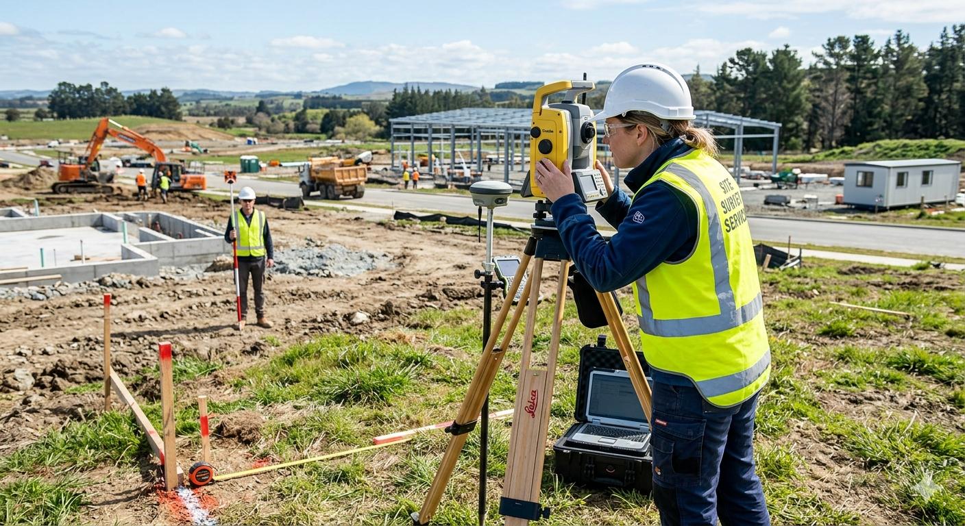
The Difference Between Detailed Surveying and Grid Leveling

Introduction
Surveying is an essential part of engineering projects, helping professionals understand site conditions and determine existing features and ground elevations before design or construction begins. Two common surveying operations are detailed surveying and grid leveling. Although both provide valuable information about a site, they differ in their objectives, data collection methods, and applications.
Detailed surveying focuses on recording existing site features and determining their coordinates and elevations to produce a detailed representation of the site. Grid leveling, on the other hand, focuses on measuring elevations at points distributed across a grid, usually to study ground levels and support earthworks calculations.
This article explains the differences between detailed surveying and grid leveling, their procedures, the equipment used, and how to select the appropriate method for a project.
1. What Is Detailed Surveying?
Detailed surveying is the process of collecting survey data about existing site conditions by determining the coordinates and elevations of points and recording natural and man-made features within the project area.
These features may include buildings, fences, roads, utility structures, poles, boundaries, and other visible elements. Surveyors may also record points representing changes in the ground surface, depending on the site's characteristics and the required level of detail.
The collected data is used to prepare detailed maps and drawings that represent existing conditions and support engineering design, planning, documentation, and construction activities.
Main Applications of Detailed Surveying
Preparing detailed site maps before design.
Recording existing buildings and structures within project boundaries.
Mapping roads, fences, poles, and visible utilities.
Determining the coordinates and elevations required for engineering works.
Supporting urban development, industrial, and infrastructure projects.
Documenting existing conditions for comparison with designs or completed works.
2. What Is Grid Leveling?

Grid leveling is a surveying process in which an area is divided into a grid of points, usually at regular intervals or according to a layout suited to the terrain and project requirements. The elevation of each point is then measured.
These measurements help surveyors understand variations in the ground surface. The resulting data can be used to prepare elevation plans and contour maps, study slopes, plan site grading, and estimate cut-and-fill quantities by comparing existing ground levels with proposed design levels.
Grid leveling is commonly used for building plots, industrial sites, land grading projects, and other areas requiring detailed information about ground elevations.
Main Applications of Grid Leveling
Determining ground elevations across a project area.
Identifying high points, low points, and ground slopes.
Preparing elevation data and contour maps.
Supporting site grading and ground preparation.
Calculating cut-and-fill quantities using existing and design elevations.
Providing elevation data for engineering design and construction.
3. What Is the Main Difference Between Detailed Surveying and Grid Leveling?
The main difference is that detailed surveying focuses on mapping existing site features, their coordinates, and their elevations, while grid leveling primarily focuses on measuring ground elevations at distributed grid points.
This does not mean that detailed surveying excludes elevation measurements or that grid leveling cannot produce mapped information. The distinction lies in the objective of the work, the distribution of measurement points, and the type of data required.
4. Detailed Surveying vs. Grid Leveling
| Comparison | Detailed Surveying | Grid Leveling |
|---|---|---|
| Main objective | Record site features and details | Determine ground elevations |
| Data collected | Coordinates, elevations, and feature descriptions | Grid-point elevations, often associated with horizontal positions |
| Point distribution | Based on features and changes in the site | Based on a regular grid or a suitable point layout |
| Main outputs | Detailed site maps and feature data | Elevation tables and ground-surface data; contour maps may also be produced |
| Common applications | Design, planning, documentation, and existing-condition mapping | Grading, earthworks, and slope analysis |
| Typical equipment | Total Station, GNSS/RTK, and other suitable instruments | Surveying level and staff, Total Station, or other suitable instruments |
| Point selection | Emphasis on features that must be represented | Emphasis on covering the area sufficiently to represent ground-level variations |
5. How Is Detailed Surveying Performed?

Detailed surveying typically involves the following stages:
Site inspection: Identify the project boundaries and the features that must be surveyed.
Reviewing reference data: Verify control points and the adopted coordinate and elevation systems, where available.
Selecting suitable equipment: Choose instruments according to site conditions and the required accuracy.
Field data collection: Measure point coordinates and elevations and record existing features.
Data processing and verification: Review measurements, organize the data, and identify errors or missing points.
Preparing deliverables: Produce detailed maps and data files suitable for the project, including digital drawings when required.
The required point density depends on the site's complexity, its surface variations, and the purpose of the survey. There is no single number of points that suits every project.
6. How Is Grid Leveling Performed?

Grid leveling generally follows these steps:
Define the survey area: Establish the boundaries of the area to be measured.
Design the grid: Divide the area into squares or distribute points at suitable intervals based on the terrain and project requirements.
Verify the vertical reference: Confirm an approved benchmark or establish the project reference according to its surveying procedures.
Measure elevations: Observe the grid points using a level and staff or another suitable surveying method.
Calculate and check elevations: Record readings, calculate point elevations, and verify measurement quality.
Analyze the ground surface: Use the data to prepare elevation tables, contour maps, or grading calculations.
Calculate cut and fill, if required: Compare existing ground elevations with design elevations and apply an appropriate calculation method to estimate earthwork quantities.
Grid spacing depends on the terrain, required accuracy, and project size. Areas with frequent ground-level changes may require a denser grid than relatively flat areas.
7. What Equipment Is Used for Each Method?
Equipment for Detailed Surveying

Total Station
Measures angles and distances to determine coordinates and record site features.

GNSS / RTK Equipment
Determines coordinates and connects site data to a suitable reference system when site conditions permit.

Leveling Instruments
Measure elevations and height differences when accurate vertical data is required.

Surveying and CAD Software
Processes survey data and prepares maps and detailed drawings.
Equipment for Grid Leveling
Surveying level and staff: Commonly used to measure height differences and determine grid-point elevations.
Total Station: Can measure and record grid points according to the selected method and accuracy requirements.
GNSS equipment: May be suitable for some projects when its vertical accuracy meets the required standards and site conditions.
Surveying software: Organizes elevation data, prepares ground-surface maps, and supports cut-and-fill calculations.
Equipment selection depends on project specifications, required accuracy, field conditions, and measurement-control procedures.
8. Practical Example: Which Method Should You Use?
Suppose a plot of land is being prepared for a new building.
If the objective is to identify existing buildings, fences, roads, poles, and visible utilities, along with the coordinates and elevations of relevant points, detailed surveying helps produce a map of existing conditions for the design team.
However, if the objective is to determine ground highs and lows, assess grading requirements, and estimate cut-and-fill quantities to achieve a proposed design elevation, grid leveling provides the elevation data needed for those calculations.
In many projects, using both methods is beneficial. Detailed surveying records existing features, while grid leveling provides structured elevation data across the site. The scope of each operation should be determined by the project's actual requirements.
9. How Do You Choose the Right Surveying Method?
The correct method depends on the question the project needs to answer.
Need a map of existing site features and details? Detailed surveying is generally appropriate.
Need ground elevations across a grid for grading calculations? Grid leveling is suitable.
Need information about both features and elevations? The project may require both methods or a detailed survey with sufficient elevation coverage for the intended purpose.
Need to calculate cut-and-fill quantities? Select the measurement and calculation method based on terrain conditions, proposed design levels, and the required quantity accuracy.
Before work begins, clarify the site boundaries, required deliverables, reference systems, accuracy requirements, and intended use of the survey data.
Conclusion
Detailed surveying and grid leveling differ in their primary objectives, point-distribution methods, and the information they emphasize. Detailed surveying represents existing site features and their coordinates and elevations, while grid leveling provides elevation data across a defined area to support ground-surface analysis, grading, and earthworks calculations.
Neither method is a universal replacement for the other. A project may require one method or a combination of both, depending on site conditions and design and construction requirements.
Need accurate surveying data for your project?
Total Surveying provides surveying services to support engineering design, planning, and construction. Contact the team to discuss your project requirements and determine the appropriate surveying scope.
Comments (0)
Be the first to comment on this article.